Summary:
It now appears that the precipitation event for Tuesday into Wednesday will be all in liquid form in Berkshire County. However, the real concern is for freezing rain (icy glaze) as the ground is cold and temperatures will be at or below freezing when the rain starts. In the main towns and lower elevations, this should only be during the morning. Temperatures in these locations should be right around 30 degrees early in the morning when some patchy light rain or showers are likely to develop early, between about 7 and 9 am. Unfortunately, this might cause some slippery roads right as folks are heading off to work and school. However, my guess is that some salt will be spread overnight and with temperatures near freezing, treated surfaces should just be mostly wet. It looks like the rain will be light during the morning and that temperatures in the lower elevations will have risen above freezing by the time heavier rain begins falling in the afternoon.
The elevated terrain is a different story. Temperatures may remain below freezing in many locations until into the evening and there could be an accumulation of ice on trees and power lines, as well as on untreated road surfaces there. Temperatures should have risen above freezing everywhere by later Tuesday night, with temperatures rising into the 40s by Wednesday morning.
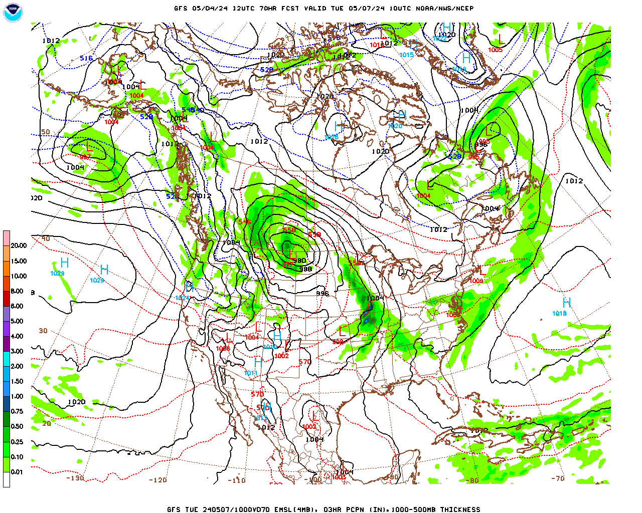
A change in the forecast that has taken place in the last couple of days is that the cold front passage on Wednesday looks like it will occur more slowly than it looked a few days ago. As a result, a surface low developing along the front and riding northeast along the front, that looked like it was going to go out to sea to our south, now looks like it may give us a some snow late Wednesday night and into the day on Thursday. However, that is a low confidence forecast at this time as the scenario is quite fluid and the models are not in agreement…..
Analysis:
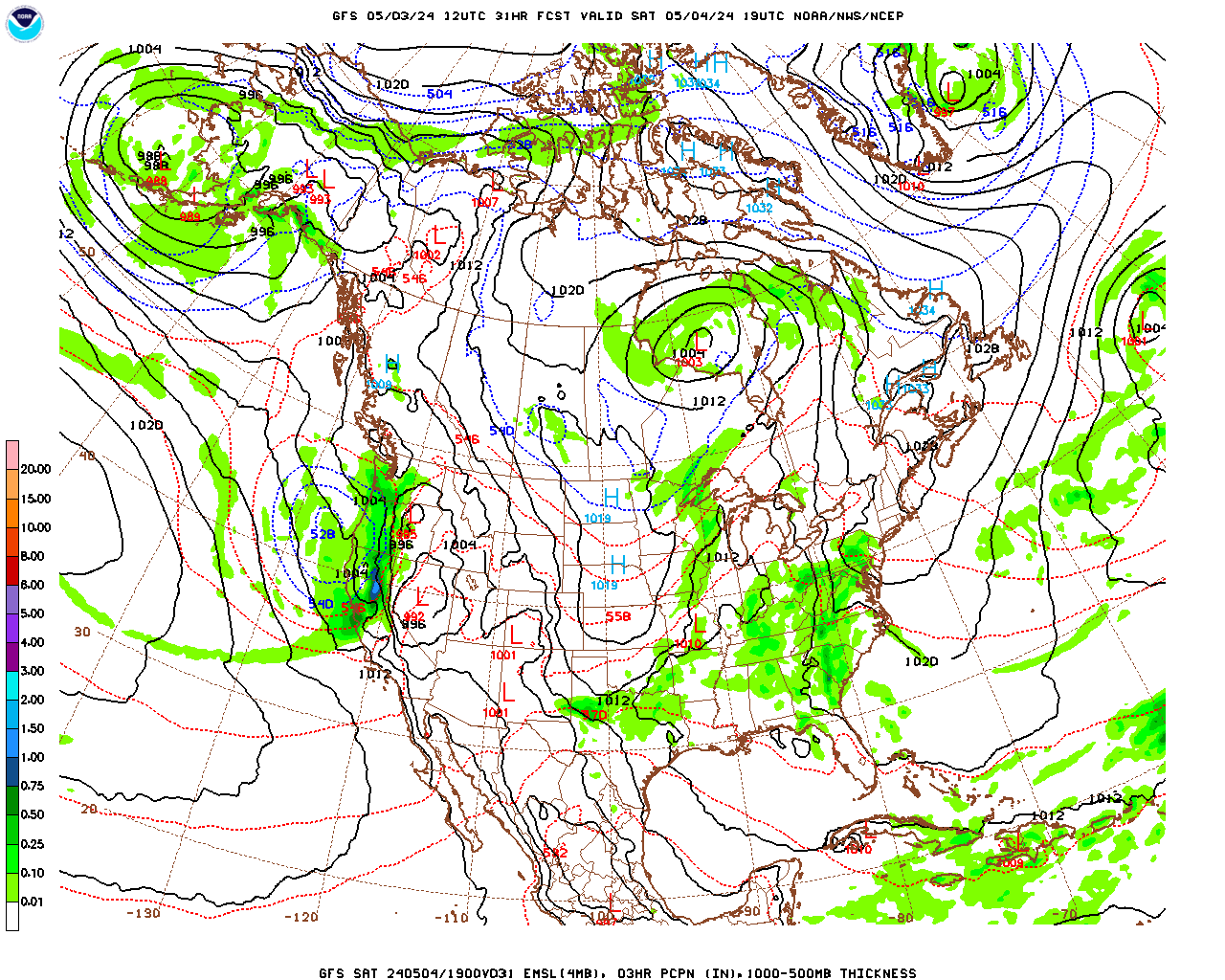
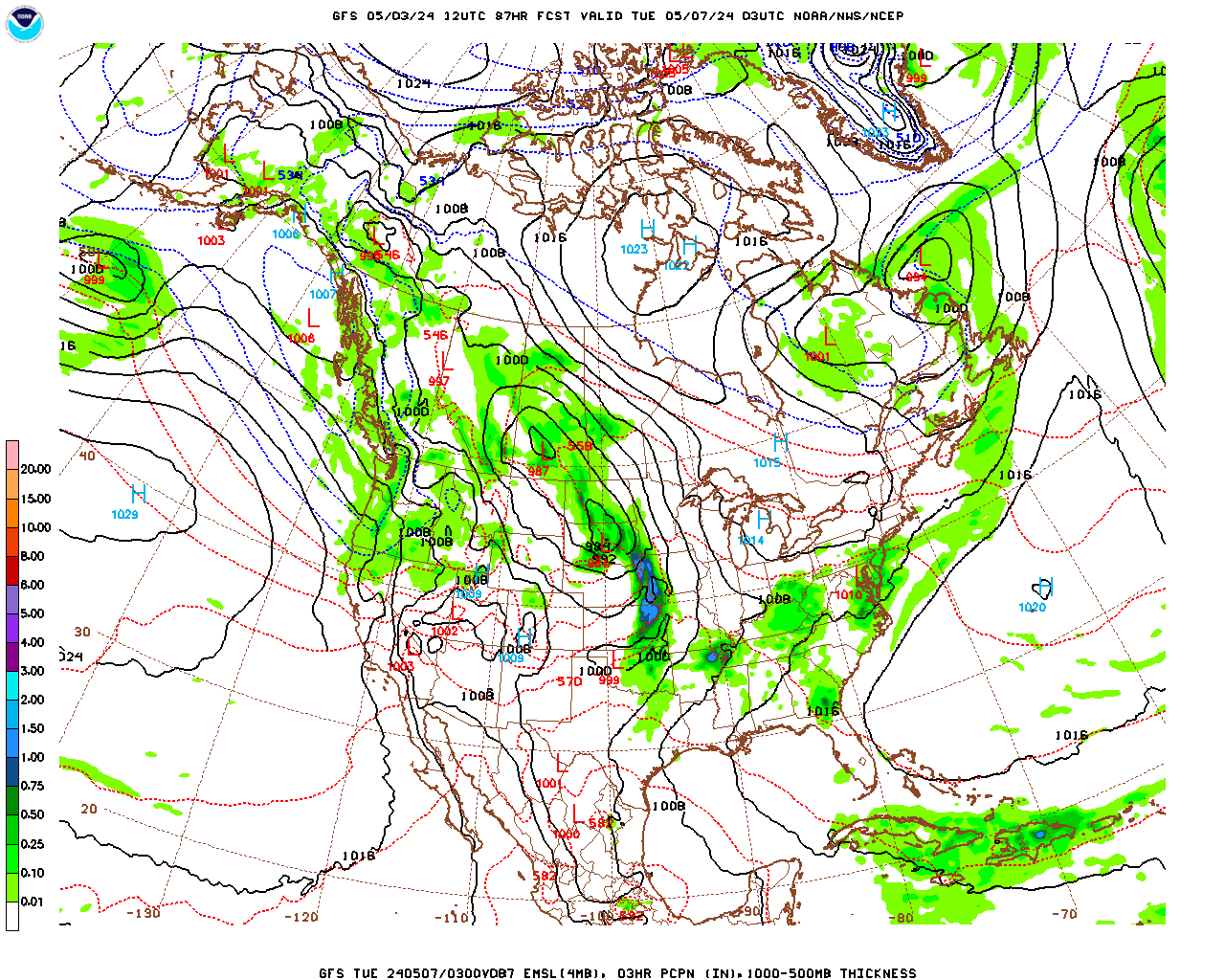
The polar front lies just to our south this afternoon. As a surface low pressure system presently over the Great Plains moves northeastward through the Great Lakes on Tuesday, counterclockwise circulation around the low will push the front to the north as a warm front. As warm air overrides cold air at the surface, freezing rain will develop across the county tomorrow. It is difficult to be certain as to when temperatures at the surface rise above freezing and the precipitation turns to plain rain but the greatest likelihood of ice accumulation will be over the elevated terrain. The precipitation should be heaviest during the afternoon and evening and then will taper off to scattered showers and light rain after midnight. Temperatures will begin to rise steadily Tuesday night, first over the lower elevations, and then over the elevated terrain as the surface warm front finally pushes through. As Berkshire County moves into the “warm sector” of the storm, between the warm and cold fronts to the south of the low, temperatures will rise into the 40s by Wednesday morning. The surface low, moving into Quebec Wednesday morning, will drag its trailing cold front across the county and temperatures will begin to fall into and through the 30s Wednesday afternoon. It will then turn much colder Thursday, and especially Friday, as the polar front (cold front I just mentioned) plunges well to our south. A surface low developing and riding along the front to our south on Thursday could bring us some snow sometime after midnight Wednesday night and into the day on Thursday. More on this later…..
Forecast:
Monday Night
Cloudy skies with temperatures holding steady in the evening and then rising after midnight. Low temperatures during the evening near 20 to low 20s over the elevated terrain, mid 20s in the lower elevations of central and northern Berkshire and mid to upper 20s in South County, rising into the mid to upper 20s over the elevated terrain, near 30 in the lower elevations of central and northern Berkshire and low 30s in the lower elevations of South County by morning. Winds light and variable in the evening, becoming easterly at 5 – 10 mph by morning.
Tuesday
Periods of light freezing rain during the morning, beginning around 8 or 9 am. Steadier and heavier rain and freezing rain during the afternoon. In the lower elevations, precipitation should be mostly plain rain during the afternoon but freezing rain will likely persist over the elevated terrain through the afternoon and into the evening. Probability of precipitation near 100%. Likely rainfall totals 0.25″ to 0.50″. Ice accumulations less than 0.10″ in the lower elevations but possibly over 0.25″ over the elevated terrain. High temperatures late in the day in the low to mid 30s in the lower elevations of central and northern Berkshire, mid 30s in the lower elevations of South County and near 30 over the elevated terrain. It will be breezy, with easterly winds at 10 – 15 mph.
Tuesday Night
Light rain and freezing rain likely during the evening, with the freezing rain isolated to the elevated terrain, with scattered light rain and showers everywhere after midnight. Probability of precipitation 80%. Likely rainfall totals 0.10″ to 0.20″. An additional 0.10″ of ice is possible over the elevated terrain during the evening. Becoming breezy and much milder after midnight, with temperatures rising through the 30s and into the 40s by morning. Easterly winds at 5- 10 mph in the evening becoming southwesterly and increasing to 10 – 15 mph after midnight.
Wednesday
A mixture of clouds and sun in the morning, becoming mostly cloudy in the afternoon. Breezy and unseasonably mild in the morning, breezy and turning colder in the afternoon. High temperatures in the morning in the mid 40s in the lower elevations of central and southern Berkshire, upper 40s in the lower elevations of South County and low to mid 40s over the elevated terrain, falling into and through the 30s during the afternoon. Southwesterly winds at 10 – 15 mph early, shifting to west-northwesterly at 10 – 15 mph late morning.
Wednesday Night and Thursday
Cloudy and much colder Wednesday night with snow possible after midnight. Low temperatures near 20. Cloudy and cold with snow likely Thursday. High temperature in the low to mid 20s.