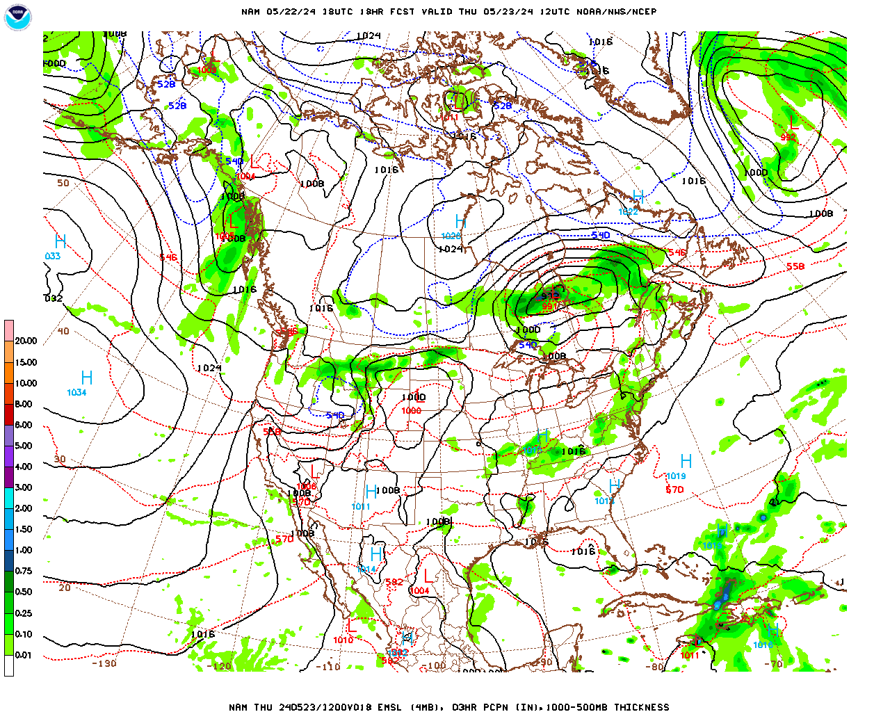
Ah, the proverbial fly in the ointment…… After I promised sunny and clear weather for the foreseeable future, it looks like we may be in for a rainy day on Thursday. A disturbance in mid and upper-levels of the atmosphere, well to the south of (cut-off from) the polar front (main) jet stream, is presently generating a very weak surface low pressure system along the Southeast coast. Since it is far removed from the jet stream, this disturbance does not have much in the way of steering currents and, thus, will move quite slowly over the next several days. The disturbance and its associated rain shield will drift slowly north over the next few days, being held at bay by surface high pressure to the north, before essentially stalling just to our south on Thursday and then drifting slowly south and east from Friday through Sunday as it, slowly, dissipates. With the lack of steering currents, and the small, compact nature of this system, it is difficult to forecast its exact track as well as how far its rain shield will extend. We will likely be on the northern edge of the rain shield on Thursday and the computer models have been somewhat divergent in their solutions, both between models and from run to run within models. However, this is the way I see it at the present time……I will update the forecast tomorrow if things change.
Clouds will be on the increase mid to late Wednesday afternoon as the system approaches from the south. It will then become overcast Wednesday night and likely remain overcast through the day Thursday and most of Thursday night. Rain will likely develop sometime Thursday morning and continue off and on for most of the day Thursday and into Thursday night. The greatest chance for rain, and the greatest amounts should be in southern and eastern portions of the county where 0.50″ may fall. In fact, it is looking like Thursday may be a very nasty day for this time of year, with temperatures holding in the 50s, in addition to the rain (ouch!)
Once the system drifts away, skies should clear on Friday and we “should” have a sunny, mild weekend, with high temperatures in the 70s, as surface high pressure rebuilds into the region.
Tuesday Night
Mostly clear and cool. Patchy fog developing after midnight.
Low temperatures in the low 40s.
Light west-northwesterly winds this evening, shifting to east-northeasterly after midnight.
Wednesday
Any patchy fog burning off during the morning, otherwise mostly sunny to partly cloudy and mild. Increasing cloudiness during the mid to late afternoon.
High temperatures in the upper 60s in Pittsfield, Adams, North Adams, Willliamstown, Lee and Stockbridge; near 70 in Great Barrington and Sheffield; and low to mid 60s over the elevated terrain.
Light east-southeasterly winds.
Wednesday Night
Mostly cloudy and not quite as cool. There is the slight chance of a shower in South County toward morning.
Low temperatures near 50.
Winds light easterly to calm.
Thursday
Mostly cloudy and cool, with occasional rain or showers likely. Probability of precipitation 60% in central Berkshire. 70% in South County and 50% in North County.
High temperatures in the mid 50s in Pittsfield, Lee, Stockbridge, Adams, North Adams and Williamstown; mid to upper 50s in Great Barrington and Sheffield and; low 50s over the elevated terrain.
Northeasterly winds at 5-10 mph.