Berkshire County Forecast-Tuesday, Sept. 30

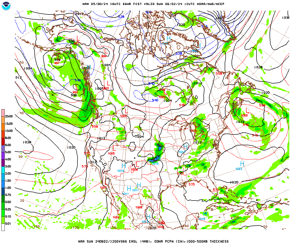
The main, polar front jet stream is located well to our north, over Canada. However, even though this usually means fair and warm weather (like this past weekend), the lack of a steering current has enabled some weak, mid and upper-level disturbances, located well south of the main jet stream, to wander into the Northeast. Thus the cloudy and, with the paucity of sunshine, somewhat cooler weather the past few days. Unfortunately, although these “meandering” disturbances have been relatively harmless in regard to our weather until now, that is about to change. One, very weak disturbance is generating an area of rain over southeastern New England. This disturbance will drift slowly out to sea. A second, stronger disturbance is presently located over the eastern Great Lakes. This disturbance is generating a weak surface low pressure system associated with clusters of slow moving showers and thunderstorms over Pennsylvania and New York state. As this disturbance drifts eastward overnight, it will begin to feed on abundant moisture off the southern New England coast. As a result, it looks like a more “coherent” area of rain and showers will develop over southern New England after midnight. As the low pressure system spins counter-clockwise the associated rain shield will likely “back up” a bit with rain and showers moving southeast to northwest back over Berkshire County toward morning. It looks like showers will likely continue off and on during the day, and even into the evening. Most of the rain should be relatively light and occur during the morning hours, with showers much more scattered during the afternoon as the disturbance drifts very slowly eastward off the coast. A caveat here…..as is usually the case with weak and poorly organized systems, this is not a high confidence forecast in terms of rainfall coverage and amounts across the county.

Since it will take quite some time for the disturbance to pull away we will probably not see clearing skies until sometime on Thursday afternoon. Weak surface high pressure will then build in to give us a mostly sunny and mild day on Friday. In the meantime, quite cold Arctic air will begin to plunge south out of Canada, being drawn south into a fairly deep trough in the jet stream wave pattern developing over the central U.S. on Friday. A strong cold front at the leading edge of this trough will plow through Berkshire County during the day on Saturday. As a result, it is looking like a period of fairly substantial rainfall will likely occur sometime on Saturday. It should then turn much cooler on Sunday, with high temperatures remaining in the 50s.

Tuesday Night

Partly to mostly cloudy this evening. Becoming mostly cloudy after midnight with rain or showers likely developing toward morning. Probability of precipitation 60%. Likely rainfall totals 0.05″ to 0.15″.

Low temperatures in the low to mid 50s.

Light east-northeasterly winds.

Wednesday

Mostly cloudy with scattered, on and off, rain showers likely. Showers are mostly likely during the morning hours but could occur at any time during the day. Probability of precipitation 60%. Any rainfall totals likely 0.10″ or less.

High temperatures near 60 in Pittsfield, Lee, Stockbridge, Adams, North Adams and Williamstown; low 60s in Great Barrington and Sheffield and; mid to upper 50s over the elevated terrain.

Northeasterly winds at 5-10 mph.

Wednesday Night

Mostly cloudy. There is a chance of a few lingering showers before midnight. Probability of precipitation 40%. Rainfall totals likely 0.05″ or less.

Low temperatures near 50.

Light north-northeasterly winds.

Thursday

Mostly cloudy in the morning. Some clearing during the afternoon.

High temperatures in the low to mid 60s in Pittsfield, Lee, Stockbridge, Adams, North Adams and Williamstown; mid 60s in Great Barrington and Sheffield and; near 60 to low 60s over the elevated terrain.

Light north-northeasterly winds.

Berkshire County Forecast-Wednesday, Sept. 24

It continues to look like we will be right on the northern edge of the rain shield tomorrow. In addition, the rain shield will tend to “break up” and evaporate as the disturbance bumps into the dry and sinking air of the broad surface high pressure system presently centered over New England. The computer models have been trending toward the high pressure system “holding” the system at bay to our south and more effectively breaking apart the precipitation then it appeared yesterday so I have decreased the precipitation probabilities from yesterday. It looks less like a “rainy day” tomorrow and more of a mostly cloudy day with just the chance of a little light rain or a few showers, with the increasing likelihood of showers the further south and east one goes within the county. It is even possible that we may see some sunshine in the afternoon tomorrow as the surface low begins to dissipate and drift southeastward over the course of the day. Some of the high resolution models are still bringing the steady rain into the county, so this is still a possibility, but I think this is much less likely than the scenario I just mentioned. If we don’t get steady rain, temperatures will also not be quite as cool as it appeared yesterday. 

Once the surface low moves away, warm and sunny surface high pressure will re-establish itself across the region and we should see mostly sunny skies and temperatures in the 70s Friday through Sunday.

Wednesday Night

Increasing clouds this evening. Becoming mostly cloudy after midnight.

Low temperatures in the upper 40s.

Light easterly winds.

Thursday

Mostly cloudy with just a chance of light rain or rain showers. Probability of precipitation 20% in North County, 30% in central Berkshire and 40% in South County. Any rainfall totals likely 0.10″ or less.

High temperatures in the low 60s in most locations, near 60 over the elevated terrain.

Northeasterly winds at 5-10 mph.

Thursday Night

Mostly cloudy with a chance of a lingering shower in the evening, then decreasing cloudiness after midnight.

Low temperatures in the mid 40s.

Light north-northeasterly winds.

Friday

Mostly sunny and warmer.

High temperatures in the low 70s in Pittsfield; low to mid 70s in Lee, Stockbridge, Adams, North Adams and Williamstown; mid 70s in Great Barrington and Sheffield and; near 70 to low 70s over the elevated terrain.

North-northwesterly winds at 5-10 mph.

Berkshire County Forecast-Tuesday, Sept. 23

Ah, the proverbial fly in the ointment…… After I promised sunny and clear weather for the foreseeable future, it looks like we may be in for a rainy day on Thursday. A disturbance in mid and upper-levels of the atmosphere, well to the south of (cut-off from) the polar front (main) jet stream, is presently generating a very weak surface low pressure system along the Southeast coast. Since it is far removed from the jet stream, this disturbance does not have much in the way of steering currents and, thus, will move quite slowly over the next several days. The disturbance and its associated rain shield will drift slowly north over the next few days, being held at bay by surface high pressure to the north, before essentially stalling just to our south on Thursday and then drifting slowly south and east from Friday through Sunday as it, slowly, dissipates. With the lack of steering currents, and the small, compact nature of this system, it is difficult to forecast its exact track as well as how far its rain shield will extend. We will likely be on the northern edge of the rain shield on Thursday and the computer models have been somewhat divergent in their solutions, both between models and from run to run within models. However, this is the way I see it at the present time……I will update the forecast tomorrow if things change.

Clouds will be on the increase mid to late Wednesday afternoon as the system approaches from the south. It will then become overcast Wednesday night and likely remain overcast through the day Thursday and most of Thursday night. Rain will likely develop sometime Thursday morning and continue off and on for most of the day Thursday and into Thursday night. The greatest chance for rain, and the greatest amounts should be in southern and eastern portions of the county where 0.50″ may fall. In fact, it is looking like Thursday may be a very nasty day for this time of year, with temperatures holding in the 50s, in addition to the rain (ouch!)

Once the system drifts away, skies should clear on Friday and we “should” have a sunny, mild weekend, with high temperatures in the 70s, as surface high pressure rebuilds into the region.

Tuesday Night

Mostly clear and cool. Patchy fog developing after midnight.

Low temperatures in the low 40s.

Light west-northwesterly winds this evening, shifting to east-northeasterly after midnight.

Wednesday

Any patchy fog burning off during the morning, otherwise mostly sunny to partly cloudy and mild. Increasing cloudiness during the mid to late afternoon.

High temperatures in the upper 60s in Pittsfield, Adams, North Adams, Willliamstown, Lee and Stockbridge; near 70 in Great Barrington and Sheffield; and low to mid 60s over the elevated terrain.

Light east-southeasterly winds.

Wednesday Night

Mostly cloudy and not quite as cool. There is the slight chance of a shower in South County toward morning.

Low temperatures near 50.

Winds light easterly to calm.

Thursday

Mostly cloudy and cool, with occasional rain or showers likely. Probability of precipitation 60% in central Berkshire. 70% in South County and 50% in North County.

High temperatures in the mid 50s in Pittsfield, Lee, Stockbridge, Adams, North Adams and Williamstown; mid to upper 50s in Great Barrington and Sheffield and; low 50s over the elevated terrain.

Northeasterly winds at 5-10 mph.

Berkshire County Forecast-Sunday, Sept. 21

A cold front approaching Berkshire County from the west is presently generating a line of showers and thunderstorms moving west to east across New York State. By the time these showers reach us, between about 11 pm and 1 am tonight, they will have lost the energy due to environmental instability generated by daytime heating and will likely only be scattered and fairly light. Once this front moves through, we should remain dry for an extended period of time, through at least next weekend, as a sprawling surface high pressure system builds in and stalls across the entire eastern half of the country. This will occur due to a shift of the jet stream into Canada, with a broad ridge in the jet stream wave pattern building across the U.S..

Following the passage of the cold front, Monday and Monday night will be much cooler, although there will be considerable cloudiness in place until the low level moisture and instability associated with the upper-level cold pool within the jet stream trough lift out on Tuesday. From Tuesday through next weekend the skies should remain mostly clear with abundant sunshine. Temperatures will also moderate over the course of the week, as the warm ridge shifts eastward, with high temperatures rising a few degrees each day, through the 60s and into the 70s by the weekend.

Sunday Night

Partly cloudy this evening. Scattered, mostly light, showers are possible late this evening, between about 11 pm and 1 am. Skies will then clear for a time before clouds increase again toward morning. It will turn breezy and cooler after midnight. Probability of precipitation 50%. Likely rainfall totals 0.10″ or less.

Low temperatures in the low to mid 50s.

Light south-southwesterly winds this evening, shifting to westerly and increasing to 10-15 mph after midnight.

Monday

Mostly cloudy, very breezy, and cooler. Some scattered sprinkles or light showers are still possible, predominantly in the morning. Probability of precipitation 30%. Measurable rainfall is unlikely.

Temperatures will not rise much over the course of the day, with high temperatures in the upper 50s in Pittsfield, Adams, North Adams, and Willliamstown; near 60 in Lee and Stockbridge; near 60 to low 60s in Great Barrington and Sheffield; and mid 50s over the elevated terrain.

West-northwesterly winds at 10-20 mph, with gusts to 30 mph, particularly over the elevated terrain.

Monday Night

Considerable cloudiness during the evening, then clearing after midnight. Diminishing winds but much cooler than previous nights.

Low temperatures in the upper 30s.

West-northwesterly winds at 5-15 mph in the evening, becoming light after midnight.

Tuesday

Mostly sunny and pleasant, with seasonable temperatures.

High temperatures in the mid 60s in Pittsfield, Lee and Stockbridge, Adams, North Adams and Williamstown; mid to upper 60s in Great Barrington and Sheffield and; near 60 to low 60s over the elevated terrain.

Northwesterly winds at 5-10 mph.

Berkshire County Forecast-Thursday, Sept. 18

A cold front is entering Berkshire County from the north this afternoon with a few widely scattered light showers. It will pass through rapidly, with clearing skies this evening. However, behind the front, a surface high pressure system containing a cool Canadian air mass will drop south over the Northeast. The coolest air will remain to our north over southeastern Canada. However, we will still likely experience the coolest air of the season so far, tonight and Friday. As skies clear and winds die down overnight we will have good conditions for “radiational cooling” with temperatures dropping into the 30s in most locations by morning. There may even be some isolated frost in a few wind sheltered valleys over the elevated terrain. Despite plenty of sunshine on Friday, temperatures will not exceed the 50s in most locations.

Over the weekend, we will see a moderating trend, with temperatures in the 60s on Saturday and the 70s on Sunday. However, even though we will likely remain dry until at least Sunday evening, the milder air will come at the expense of greater amounts of cloudiness. A weak warm front, heralding the leading edge of a ridge in the jet stream wave pattern, extending south and east from a surface low pressure system moving through the northern Great Lakes, will move through our region on Saturday. As the warmer air overrides cooler air at the surface considerable cloudiness will be generated. In fact, it will likely be mostly cloudy during the morning and into the afternoon with some additional peaks of sunshine, lets call it “partly sunny”, developing late in the day. Despite the much milder air being driven in on southerly breezes around the departing high pressure system (clockwise flow), that will be over us Friday, we will still probably only peak out in the low to mid 60s on Saturday due to the extensive cloud cover.

Skies will be clearer Saturday night and Sunday once the warm front passes and with greater sunshine on Sunday temperatures could soar well into the 70s. It will likely reach the mid 70s in most places and could even touch the upper 70s, particularly in South County, if we receive enough sunshine. Once the ridge in the jet stream progresses eastward, another trough will approach, with a cold front at its leading edge passing through on Sunday evening/night. This will likely generate a band of showers during the evening or overnight Sunday night.

After the cold front passes, we may be in for an extended period of early fall weather next week as a large, sprawling surface high pressure system develops on the back side of the jet stream trough, extending westward into a broad ridge over the eastern and midwestern U.S., as the jet stream lifts north into Canada. The only fly in the ointment is a weak disturbance that may ride through the base of the trough with nothing more than a light shower Tuesday morning. Otherwise we could see mostly sunny skies from Monday through the following weekend, with cool temperatures early in the week and moderating temperatures later in the week.

Thursday Night

Clearing this evening, then mostly clear and quite cool. Isolated frost possible in a few wind sheltered valley locations over the elevated terrain.

Low temperatures generally in the mid to upper 30s, with some low to mid 30s possible over the elevated terrain.

Northwesterly winds at 5-10 mph, becoming light and shifting to north-northeasterly after midnight.

Friday

Sunny and cooler.

High temperatures in the upper 50s in Pittsfield, Adams, North Adams, Willliamstown, Lee and Stockbridge; near 60 in Great Barrington and Sheffield; and low to mid 50s over the elevated terrain.

Light northeasterly winds, shifting to southeasterly during the afternoon.

Friday Night

Mostly clear during the evening. Increasing low clouds toward daybreak.

Low temperatures generally in the low 40s, some upper 30s are possible over the elevated terrain.

Light south-southeasterly winds.

Saturday

Mostly cloudy through the morning and into the afternoon. Becoming partly sunny late, particularly in South County. Somewhat breezy and slightly milder, although it will likely still feel cool with limited sunshine and a breeze.

High temperatures in the low to mid 60s in Pittsfield, Lee and Stockbridge, Adams, North Adams and Williamstown; mid to upper 60s in Great Barrington and Sheffield and; low 60s over the elevated terrain.

Southerly winds at 8-12 mph.

Saturday Night and Sunday

Partly cloudy and unseasonably mild. A chance of a shower late on Sunday. Low temperatures averaging in the mid 50s, and high temperatures on Sunday averaging in the mid 70s.

Berkshire County Forecast-Tuesday, Sept. 16

It appears that our fairly typical early fall weather pattern will continue for the foreseeable future. The jet stream wave pattern is quite “rhythmic” and progressive, with alternating ridges and troughs moving across the northern tier of the U.S. and southern Canada. As a result, our pattern of alternating surface high pressure systems, interrupted by cold frontal passages will continue. As a trough in the jet stream wave pattern moves in, as it is now, a cold front at the leading edge ushers in cooler air from Canada (north of the jet stream). Surface high pressure then builds in behind the cold front, along the western side of the trough, as it progresses eastward. This brings relatively clear skies (descending air) and cool temperatures. Once the trough moves to our east and a ridge begins to build in, milder air within the ridge (south of the jet stream) surges northward, driven at the surface by southwesterly winds around the western side of the surface high as it moves to our east (clockwise flow). Another trough follows the ridge and a cold front at its leading edge once again lifts the mild, moister air in place. This results in a period of rain or showers (cold front passage) followed by cool, dry surface high pressure…..and this pattern continues…..

A seasonably cool surface high pressure system is presently building slowly in behind the cold/cool front which passed through Berkshire County this morning. As a result, skies should clear this evening and we can look forward to a clear, cool night tonight followed by a mostly sunny and seasonably cool day on Wednesday, with weather Wednesday night similar to tonight (clear and cool). There will likely be some patchy fog after midnight tonight as residual moisture from today’s rain condenses in the low levels of the atmosphere as temperatures drop into the low 40s by morning.

On Thursday, a weak cool front will pass through Berkshire County from the north around midday. However, the air in advance of the front will be quite dry so we are likely to only see some clouds from this frontal passage, with only a slight chance of a sprinkle or light shower. Even stronger, and slightly cooler high pressure will build in behind the front and it should be mostly sunny and even cooler on Friday, with temperatures struggling to get out of the 50s in most locations, despite the sunshine. In fact, frost is a strong possibility Thursday night as winds die out as the surface high pressure system crests over the region. The high pressure system will then drift to our east on Saturday and a ridge will begin to build in. Southwesterly winds around the high will drive daytime temperatures to near 70 on Saturday and, likely, into the 70s on Sunday before the next cold front passes with showers Sunday night or Monday.

Tuesday Night

Becoming mostly clear and cool with light winds. Patchy fog likely developing after midnight.

Low temperatures generally in the low 40s, with some upper 30s possible over the elevated terrain.

Light northwesterly winds.

Wednesday

Mostly sunny and seasonably cool.

High temperatures in the mid 60s in Pittsfield, Adams, North Adams, Willliamstown, Lee and Stockbridge; mid to upper 60s in Great Barrington and Sheffield; and near 60 to low 60s over the elevated terrain.

Light westerly winds.

Wednesday Night

Mostly clear, calm and cool.

Low temperatures, again, generally in the low 40s.

Calm winds.

Thursday

A mixture of clouds and sun with seasonably cool temperatures. The day should start out and end mostly sunny, with a period of greater cloudiness from the late morning into the early to mid afternoon, with only a slight chance of a light shower or sprinkle, as a cold front passes.

High temperatures in the mid 60s in Pittsfield, Lee and Stockbridge; low to mid 60s in Adams, North Adams and Williamstown; mid to upper 60s in Great Barrington and Sheffield and; near 60 to low 60s over the elevated terrain.

Northwesterly winds at 5-10 mph in the morning, increasing to 10-15 mph during the afternoon.

Thursday Night and Friday

Clear, calm and cold overnight, with possible frost. Low temperatures in the mid 30s, with some spots in the low 30s. Mostly sunny and quite cool on Friday. High temperatures averaging in the upper 50s.

Berkshire County Forecast-Wednesday, Sept. 10

A deep trough in the jet stream wave pattern is generating a fairly vigorous low pressure system for this time of year along its eastern margin. This low pressure system is presently moving northeastward through the Great Lakes and is generating a large shield of rain in the northern Great Lakes and into southern Ontario. A cold front trailing south from the low is generating a band of showers and thunderstorms in the eastern Great Lakes and portions of the Midwest. This cold front will move through Berkshire County late Thursday afternoon and early Thursday evening. This will result in scattered showers during the day Thursday as the front lifts relatively warm and moist air which will move into the region tonight and tomorrow on southerly winds in advance of the front. The strongest lifting associated with the front will lift north of our region with the associated low pressure system so showers are likely to be scattered and light to moderate. There may be a few imbedded rumbles of thunder with the actual frontal passage late in the day. However, instability will be limited with cloud cover most of the day so thunderstorms are relatively unlikely. Showers could occur at any time during the day but are most likely during the afternoon and into early evening.

The frontal passage will open the door to the coolest airmass of the season so far, although the coolest air will remain well to our north over Canada. Still, temperatures will struggle into the low to mid 60s during the day, despite sunshine on Friday, and may not get out of the upper 50s over some parts of the elevated terrain. Sprawling surface high pressure will build slowly into the eastern U.S. as the trough inches eastward and then stalls into a “standing wave” pattern that we have seen for a good part of this year, with a trough over the eastern U.S. and a ridge to the west. As a result, it should remain relatively cool for the foreseeable future, until a strong enough disturbance in the jet stream comes along to give the wave pattern a “kick” and get it propagating eastward again. Fortunately for us, the eastern edge of the trough, which is where surface lows (storms) are generated, will be located just far enough to our east so that whatever weak lows are generated pass well to our south and east and surface high pressure along western and central portions of the trough can dominate our weather into early next week. As a result, despite the cool temperatures, it should remain relatively fair and sunny. The only fly in the ointment is a weak jet stream disturbance rotating through the trough on Saturday and Saturday night. However, it should remain far enough to our north that we only see some cloudiness with just a slight chance of a light shower or sprinkle Saturday evening.

Wednesday Night

Increasing and thickening clouds this evening, becoming mostly cloudy after midnight. Milder than previous nights. There is a slight chance of a shower toward daybreak. Probability of precipitation 20%. Rainfall totals should be 0.05″ or less.

Low temperatures generally in the upper 50s, near 60 in South County.

Light southeasterly winds this evening, becoming southerly and increasing to 8-12 mph after midnight.

Thursday

Mostly cloudy, breezy and mild. Showers are likely, predominantly from mid afternoon to early evening. Probability of precipitation 70%. Rainfall totals most likely between 0.10″ and 0.25″.

High temperatures in the low 70s in Adams, North Adams, Williamstown, Pittsfield, Lee and Stockbridge; low to mid 70s in Great Barrington and Sheffield; and near 70 over the elevated terrain.

Southerly winds at 10-15 mph, shifting to northwesterly towards evening.

Thursday Night

Mostly cloudy in the evening with a slight chance of a light shower or sprinkle, then gradually clearing skies after midnight. Becoming much cooler and drier, with a bit of a breeze.

Low temperatures in the mid to upper 40s, with some low 40s over the elevated terrain, particularly in North County.

Northwesterly winds at 8-12 mph.

Friday

Mostly sunny and cooler.

High temperatures in the low to mid 60s in Pittsfield, Adams, North Adams, Williamstown, Lee and Stockbridge; mid 60s in Great Barrington and Sheffield and; near 60 over the elevated terrain.

Northwesterly winds at 5-10 mph.

Berkshire County Forecast-Monday, September 8

A surface high pressure system over the Canadian Maritime which has been dominating our weather with fair skies and seasonable temperatures for the past few days will continue to drift slowly eastward. We will remain under its influence for an additional few days, with dry and tranquil early September weather. A series of weak surface low pressure systems along a stalled frontal boundary, will move by to our south, off the Mid-Atlantic coast over the next few days. The northern edge of their cloud shield will waver back and forth, close to Berkshire County. As a result, cloudiness will be variable and difficult to forecast over the county. However, their precipitation shield will remain well to our south so we will remain dry.

As mentioned last week, a deep trough in the jet stream wave pattern over central and western Canada will propagate south and eastward over the northern tier of the U.S. over the next several days. A strong cold front at the leading edge of the trough should finally reach Berkshire County late Thursday afternoon or Thursday night. A round of showers and/or thunderstorms is likely with the frontal passage and then temperatures will drop below average from Friday, through next weekend and into the following week as the unseasonably cold air within the core of the trough (the origin of this air mass is northern Canada, where cold air is starting to amass) nudges eastward. The coldest of the air will stay to our north and west. However, daytime temperatures should still struggle to get past the low to mid 60s for several days. It is likely to be dry for most of this period (Friday into early the following week) as surface high pressure builds in slowly behind the front.

Monday Night

Mostly clear and cool.

Low temperatures in the mid to upper 40s.

Light east-southeasterly winds this evening, becoming calm after midnight.

Tuesday

Partly cloudy with seasonable temperatures.

High temperatures near 70 in Adams, North Adams, Williamstown, Pittsfield, Lee and Stockbridge; low 70s in Great Barrington and Sheffield; and mid to upper 60s over the elevated terrain.

East-southeasterly winds at 5-10 mph.

Tuesday Night

Partly cloudy and not quite as cool.

Low temperatures in the low 50s.

Light east-southeasterly winds.

Wednesday

Partly cloudy and slightly milder.

High temperatures in the low 70s in Pittsfield, Adams, North Adams, Williamstown, Lee and Stockbridge; low to mid 70s in Great Barrington and Sheffield and; upper 60s to near 70 over the elevated terrain.

East-southeasterly winds at 5-10 mph.

Berkshire County Forecast-Friday, September 5

It will remain uncomfortably warm and humid overnight tonight (one of the warmest and muggiest nights of the summer) and during much of the day Saturday. However, a fairly strong cold front, at the leading edge of a trough in the jet stream wave pattern, will pass through the county, from northwest to southeast, between 5 and 7 pm on Saturday. This will result in a marked drop in temperature and humidity as a continental polar surface high pressure system from the upper midwest replaces the warm and humid air mass, resulting from the maritime tropical “Bermuda High”, which is presently in control of our weather.

The cold frontal passage will generate fairly widespread thunderstorms during the afternoon and evening on Saturday, as the cooler air behind the front lifts the warm, moist, unstable air over the region. The air will become even more unstable as we will likely get enough sunshine through midday to drive surface temperatures to, and probably, exceeding 80 degrees. The Storm Prediction Center has issued a forecast of a “slight” chance of “severe” thunderstorms (15% probability within 25 miles of any point). However, the risk is primarily for damaging “straight-line” wind gusts. It does not appear that there will be enough wind shear to generate significant supercell (rotating) thunderstorms that could spawn tornadoes. Some of the high-resolution models are generating a “prefrontal” band of thunderstorms which would move through the county from northwest to southeast during the early afternoon. I think this is a likely scenario. A second band of thunderstorms, accompanying the frontal passage, will likely pass through the county between 5 and 7 pm. I believe most places in the county will experience a thunderstorm at some point on Saturday, possibly in the early afternoon, but more likely during the late afternoon to evening period as the front passes.

Temperatures will plummet from the 80s to the 60s as the thunderstorms move through, then into the 50s during the evening. Temperatures will continue to drop overnight Saturday, falling to near 50 by Sunday morning. It will be mostly sunny both Sunday and Monday as surface high pressure re-establishes control of our weather. Temperatures will return to seasonal levels, with highs in the low 70s on average and it will be much drier, with dewpoints in the upper 40s, compared with the low 70s of today. This high pressure system should maintain control of our weather into mid-week as it drifts slowly off the coast. Another, much more amplified, trough in the jet stream wave pattern will likely develop over central portions of the continent during the week next week and propagate through our region late in the week and through next weekend. It looks like this trough will contain much cooler air from Canada and could give us our first taste of Autumn, with temperatures struggling to get out of the 50s (?) next weekend.

Friday Night

Mostly clear. Unseasonably warm and humid.

Low temperatures generally in the upper 60s to near 70 with some low 70s in South County.

South-southwesterly winds at 5-10 mph this evening, becoming light after midnight.

Saturday

Mostly sunny to partly cloudy into early afternoon. Very warm and humid. Thunderstorms likely in the afternoon into early evening, with a band of thunderstorms possible in the early afternoon, and a second band more likely between 5 and 7 pm. Gusty winds and heavy downpours will likely accompany some of these storms. Probability of precipitation 80%.

High temperatures in the low 80s in Adams, North Adams, Williamstown and over the elevated terrain; low to mid 80s in Pittsfield, Lee and Stockbridge; and mid 80s in Great Barrington and Sheffield.

South-southwesterly winds at 5-10 mph in the morning, becoming southwesterly and increasing to 10-15 mph in the afternoon, and then shifting to west-northwesterly between 5 and 7 pm. Strong gusts likely in thunderstorms.

Saturday Night

A few lingering showers early, then clearing skies and much cooler and drier.

Temperatures falling through the 60s and into the 50s during the evening. Low temperatures near 50 to low 50s by morning.

Northwesterly winds at 5-10 mph, becoming light after midnight.

Sunday

Mostly sunny, with seasonable temperatures and low humidity.

High temperatures in the low 70s in Pittsfield, Adams, North Adams, Williamstown, Lee and Stockbridge; low to mid 70s in Great Barrington and Sheffield and; upper 60s to near 70 over the elevated terrain.

Northwesterly winds at 5-10 mph.

Sunday Night and Monday

Mostly clear overnight and mostly sunny on Monday. Seasonable temperatures and low humidity, with overnight lows averaging in the mid to upper 40s with highs in the low 70s.

Berkshire County Forecast, Wednesday, September 3

Now that the fall semester has begun, I will once again be providing forecasts for Berkshire County. I will post a new forecast every other day, on average, but provide updates for any significant changes. Once winter weather events begin to occur, as was the case last year, I will give more frequent updates as needed. The students in the Introduction to Meteorology class (ATM-145) will begin making forecasts with me sometime in October. Real-time weather data from the BCC Weather Station can be found by clicking on the “BCC Weather Station” link (rainwise.net/weather/bcc) on the bottom blue strip of the BCC web homepage (www.berkshirecc.edu).

A brief note to anyone who is interested….A new Atmospheric Science 2 year A.A. program has been established at BCC starting this year. An articulation agreement has been reached with SUNY Albany (University at Albany) so that, upon completion of BCC’s program, students can transfer directly into the 3rd year of their Atmospheric Science B.S. program (one of the best in the country). As a result, Berkshire County students interested in a career in Meteorology or Climate Science can complete the first 2 years of a B.S. degree in Atmospheric Science in a local community college setting at a markedly reduced cost compared to a 4 yr. school. Anyone who is interested, feel free to contact me at: jkravitz@berkshirecc.edu.

On to the weather….. A cold front passed through Berkshire County yesterday afternoon and evening resulting in scattered thunderstorms during the afternoon in the unstable air in advance of the front, followed by a period of steady rain with the actual frontal passage during the late evening hours. Cooler and much drier air moved in behind the front today. Most notably, dewpoints were much more comfortable, near 60, today compared with almost unbearable dewpoints, near 70, on Monday and Tuesday. The lower dewpoints and light winds will permit significant radiational cooling tonight, with temperatures falling well down into the 50s. The “Bermuda High” (semi-permanent subtropical high pressure system located off the Atlantic Coast) will re-establish its control over our weather over the next few days, with temperatures increasing and moisture levels rising through Friday. Skies should remain relatively clear over the next few days, however, with surface high pressure in control.

Cold air is beginning to build over northern Canada and will push far enough south to generate a trough in the jet stream wave pattern over the western U.S. late this week. This trough will propagate eastward, with a cold front along the leading edge of the trough reaching Berkshire County on Saturday. As the cool air plows into, and lifts, the unstable unseasonably warm and humid air over the Northeast, a line of thunderstorms, possibly severe, will likely develop over New York and then move through Berkshire County sometime on Saturday. Once the cold front moves through, a much cooler continental Polar (cP) airmass (surface high pressure system) will build in and dominate our weather into midweek next week. There should be plenty of sun, and the air will be much drier, but temperatures will struggle to get out of the 60s on both Sunday and Monday.

Wednesday Night

Clear, calm and comfortable.

Low temperatures in the low to mid 50s.

Light westerly winds this evening, becoming calm after midnight.

Thursday

Clear and sunny in the morning. Remaining mostly sunny in the afternoon, with some build up of fair-weather cumulus clouds, particularly over the elevated terrain. It will be unseasonably warm, but humidity will remain low.

High temperatures in the low 80s in Pittsfield, Adams, North Adams, Williamstown, Lee and Stockbridge; low to mid 80s in Great Barrington and Sheffield and; near 80 over the elevated terrain.

Winds light and variable in the morning, becoming southwesterly at 5-10 mph in the afternoon.

Thursday Night

Clear, calm and seasonably cool.

Low temperatures in the mid 50s.

Calm winds.

Friday

Mostly sunny, unseasonably warm and becoming muggy.

High temperatures in the low to mid 80s in Pittsfield, Adams, North Adams, Williamstown, Lee and Stockbridge; mid 80s in Great Barrington and Sheffield and; low 80s over the elevated terrain.

South-southwesterly winds at 8-12 mph.