Posted at 3:00 pm
Analysis:
The polar front, at the leading edge of a trough in the upper-level wave pattern, will pass through this afternoon, represented at the surface by a cold front. As a result, our temperatures will plummet overnight as the front moves to our south and then stalls over the Mid-Atlantic states. Temperatures will fall to near 20 by morning.
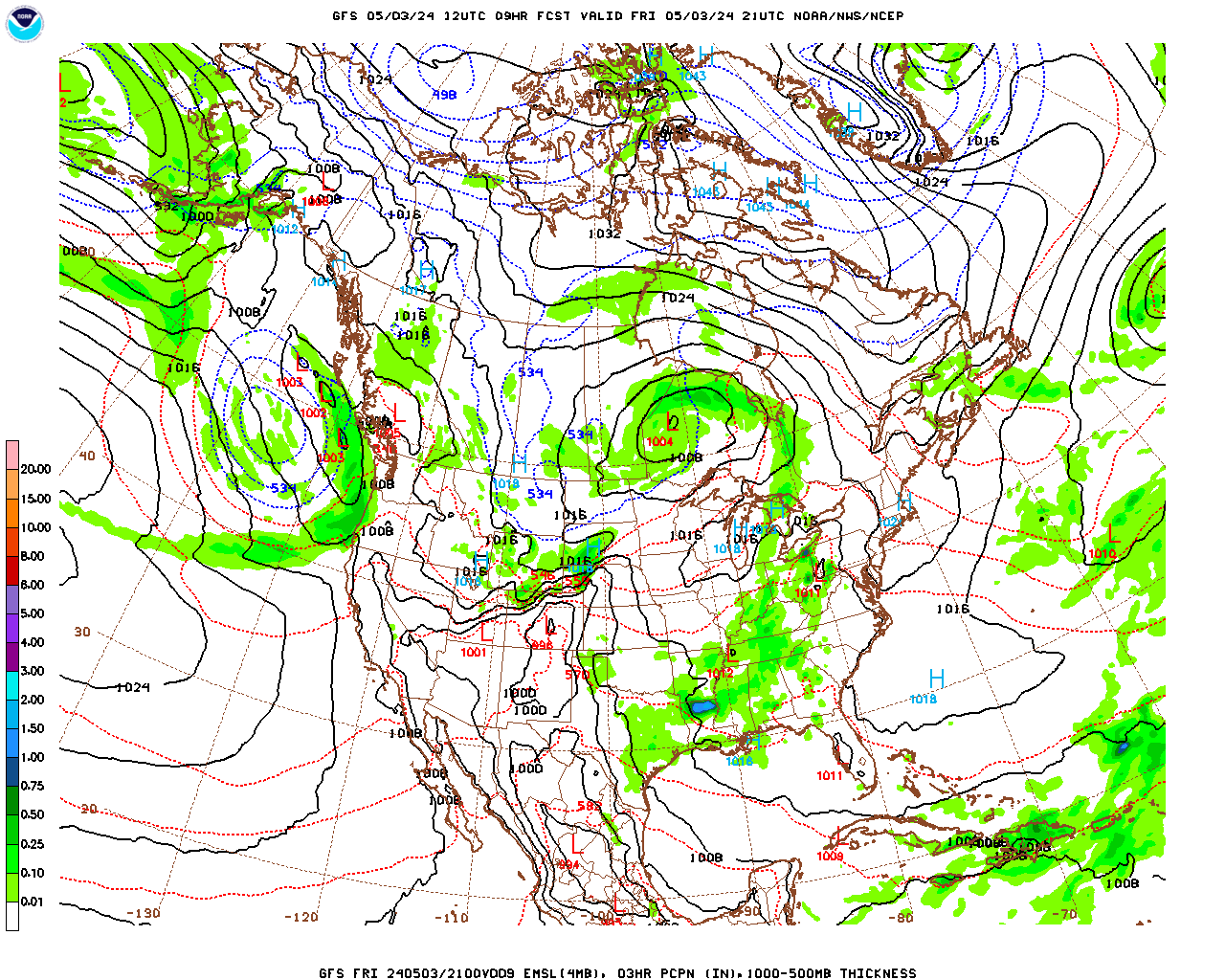
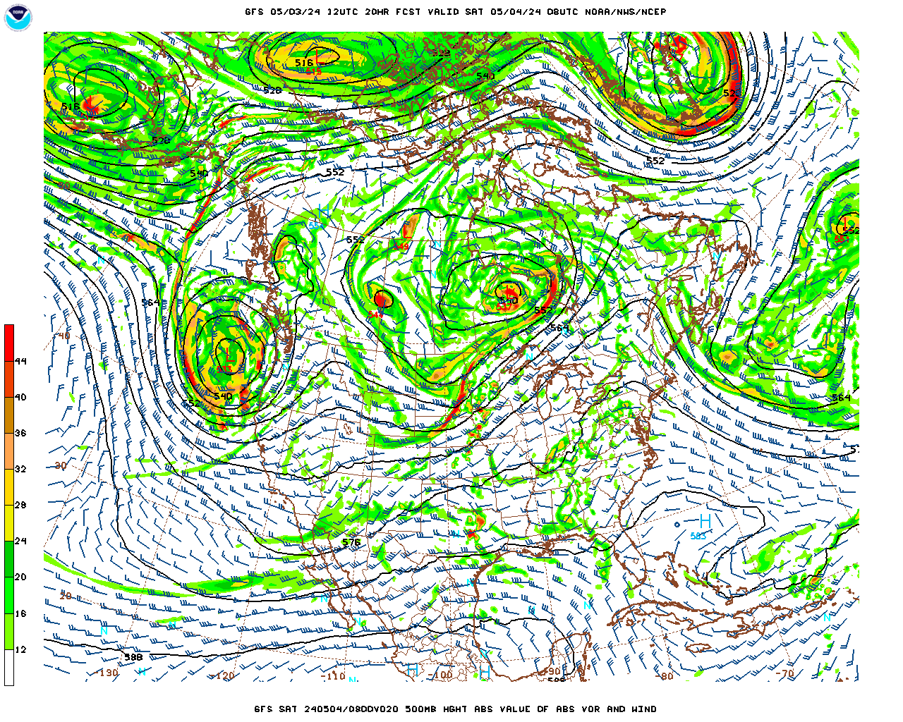
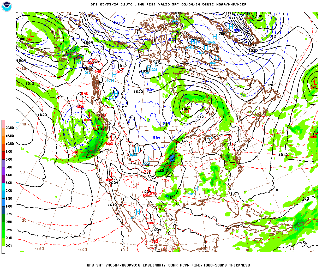
Meanwhile, an upper-level disturbance (vorticity maximum) moving into the base of this trough (over Missouri) is generating upward motion and thus an area of snow extending from Missouri and Iowa eastward through Ohio. An associated surface low center is not yet recognizable. However, as the disturbance moves east and rotates through the base of the trough overnight it will become stronger as it amplifies the trough. As a result, upward motion will increase as a surface low pressure center develops in Virginia this evening. The low will intensify fairly rapidly as it moves off the DelMarva Peninsula early Thursday morning and then tracks southeast of Cape Cod Thursday afternoon. This type of intensification is typical for a “noreaster” type low as it moves offshore and the trough begins to tilt in a negative (east to west) orientation, which enhances vorticity advection (driver of upward motion) and the upward motion is enhanced by the instability created as the cold upper low moves over the warmer ocean waters.
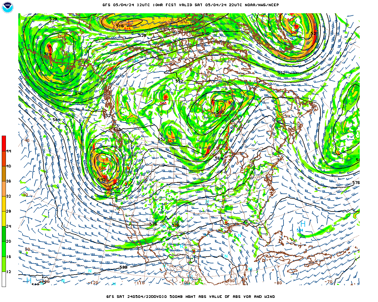
Snow should develop over the county between 4 and 6 am Thursday morning and continue, heavy at times, through the morning before tapering off in the early afternoon and end by mid-afternoon, although there could be a few lingering flurries or snow showers until evening. Even though this storm is a quick mover, the air both at the surface and aloft will be quite cold which should make for high liquid to snow ratios of 15-20:1. As a result, snowfall rates could be 1-2″ per hour at times during the morning. Unlike slow moving storms with enhanced snowfall over the elevated terrain to the east due to upslope effect from the east/northeasterly winds (winds will be more northerly with this storm), the snowfall totals should be more uniform across the county with this storm. Taking all things into consideration, it looks like the most likely snowfall totals should be 8 – 12″. Highest totals are most likely in the elevated terrain to the southeast (e.g. Otis and Becket) with the lower end of the range more likely in the northwest portions of the county.
Temperatures should drop slowly during the day as northerly winds pump colder air south, reaching the low to mid teens late in the afternoon. Windchill temperatures will likely fall below zero as the pressure gradient associated with the intensifying storm generates strong north-northwesterly winds during the afternoon. Expect blowing snow with some drifting during the afternoon and evening.
As the low moves over the Canadian Maritime Thursday night into Friday and the amplified trough becomes centered over the region it will remain cold and windy through Friday. A clipper type low will move through Friday night into Saturday with an inch or two of additional snow and then temperatures moderate over the weekend as the trough lifts out.
Forecast:
Wednesday Night
Mostly cloudy and turning colder this evening. Becoming overcast after midnight with snow developing around 4 – 6 am. Likely snowfall totals 1 – 3″ by 7 am. Low temperatures near 2o. Northwesterly winds at 5 – 10 mph this evening, shifting to northerly after midnight.
Thursday
Snow, heavy at times, during the morning, tapering off in the early afternoon and ending by mid afternoon except for a few lingering flurries or snow showers. Probability of precipitation near 100%. Likely storm total snowfall 8 – 12″. Accumulations should be fairly uniform across the county but the highest end of this range is most likely in the elevated terrain in the southeastern portions (e.g. Otis and Becket) and the lowest end of the range more likely in northwestern portions (e.g. Williamstown). It will be cold and become windy during the afternoon. Temperatures should fall slowly throughout the day, reaching the low to mid teens by late afternoon. Northerly winds at 5 – 10 mph in the morning will become northwesterly and increase to 15 – 25 mph with gusts to 35 mph during the afternoon. Wind chill temperatures as low as single digits below zero during the afternoon.
Thursday Night
Clearing during the evening, then clear to partly cloudy, windy and cold. Low temperatures in the mid single digits, low single digits over the elevated terrain. Northwest winds at 15 – 25 mph, with gusts to 35 mph. Wind chill temperatures zero to -10.
Friday
A mix of clouds and sun, windy and cold during the morning, becoming mostly cloudy with diminishing winds during the afternoon. High temperatures in the mid teens in the lower elevations of central and northern Berkshire, upper teens in the lower elevations of South County, low teens over the elevated terrain. Northwest winds at 15 – 25 mph, with gusts to 35 mph during the morning, diminishing to 5 – 10 mph late. Wind chill temperatures near zero to -10 during the morning, single digits above zero during the afternoon.