Berkshire County Forecast-Friday, Oct. 3

The following forecast is provided by Allen Chague as part of lab work for the Introduction to Meteorology course (ATM-145) under my supervision. The forecast discussion is mine…….

An amplified trough in the jet stream wave pattern is centered to our west with a stalled frontal boundary along its eastern edge, aligned southwest to northeast, just off the East Coast. A series of mid/upper-level disturbances (three in total) will rotate through the base of the trough over the next few days. Each of these will generate a surface low pressure system that will ride northeastward along the front. The first of these is presently generating a very weak low pressure system well off the Mid-Atlantic Coast that will move out to sea and dissipate. The second, somewhat stronger disturbance will generate a slightly more significant low pressure system, although still fairly weak, off the Mid-Atlantic Coast on Saturday that will move northeastward, by Cape Cod and into the Gulf of Maine, Saturday night. Berkshire County will be on the western edge of the precipitation shield of this “storm” during Saturday afternoon and into the evening. I think we are likely to see a period of light precipitation or showers during the afternoon and into the early evening on Saturday. Whether we will get snow or rain is also a tough call. Temperatures aloft are cold enough to support snow but the boundary layer is still fairly warm. I think that early afternoon any precipitation that falls will likely be rain everywhere. By mid afternoon the rain may change to snow over the elevated terrain and then by 5 or 6 pm any precipitation that falls will likely be snow everywhere. It looks like precipitation totals will likely be about 0.10″ liquid equivalent, possibly as much as 0.20″ over the hill towns to the east, so I wouldn’t expect to see anything more than a light coating of wet snow on grassy surfaces, predominantly over the elevated terrain and hill towns to the east (Windsor, Peru, Savoy, etc.).

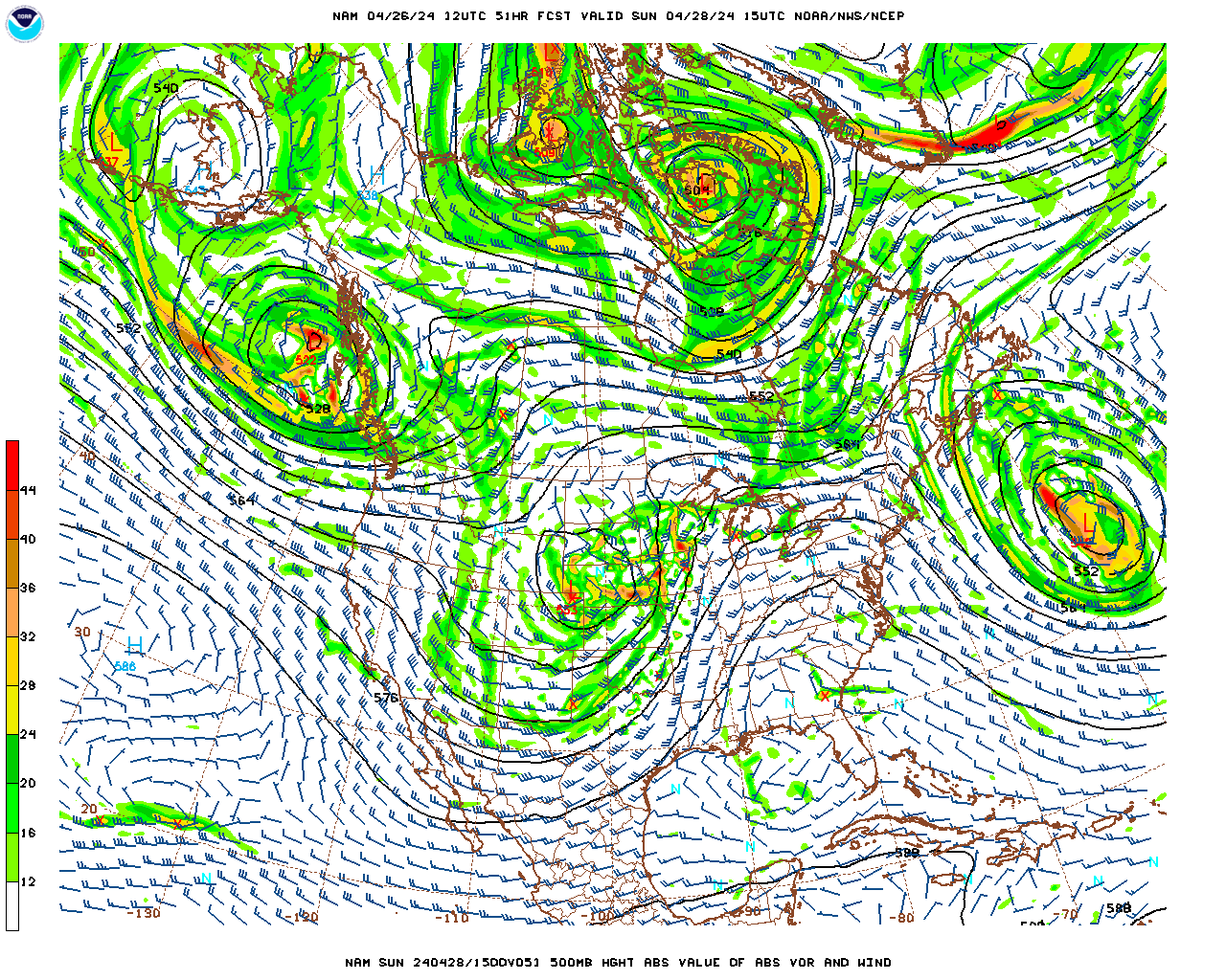
A much more vigorous disturbance (cold pool aloft), that is responsible for the amplification of the trough, will rotate through the base of the trough Saturday night and Sunday and generate a much deeper surface low off the coast. However, this low should track well to our east as the movement of the disturbance through the trough generates enough momentum to finally drag the axis of the trough eastward. As a result, we should not receive any precipitation in Berkshire County from this low. However, the axis of this very cold trough (for this time of year) will be centered over us on Sunday so, despite sunshine during the afternoon, temperatures will struggle to reach 40. In addition, the pressure gradient being generated by the strengthening low off the coast and strong high pressure moving in from the west will result in fairly strong winds, 15-25 mph (stronger gusts) during the day Sunday so it will feel even colder (wind chills). Temperatures will plummet Sunday night, possibly reaching a low of 20 in some places. It should remain breezy as well so wind chills are likely to drop into the single digits by Monday morning. Surface high pressure will crest to our southwest on Monday as the trough finally begins to lift out. Monday should turn out mostly sunny, but it will still be somewhat breezy and cool but it looks like temperatures will be slightly milder, reaching into the 40s in most locations.

Friday Night

Partly to mostly cloudy and seasonably cold.

Low temperatures in the mid 30s, upper 30s in South County.

East-northeasterly winds at 5-10 mph, shifting to northeasterly after midnight.

Saturday

Mostly cloudy early, becoming overcast by mid-morning. A period of light precipitation or showers likely developing during the early afternoon and continuing off and on into the evening. Rain is likely in the lower elevations during the afternoon, with any precipitation turning to wet snow by 5 or 6 pm. The changeover to wet snow will likely occur during the mid afternoon over the elevated terrain. Probability of precipitation 70%. Likely rainfall equivalent totals 0.10″, to as much as 0.20″ over the elevated terrain to the east. Likely snowfall totals, a coating of wet snow on grassy surfaces, predominantly in the higher terrain to the east.

High temperatures in the low 40s in Pittsfield, Lee, Stockbridge, Adams, North Adams, and Williamstown; low to mid 40s in Great Barrington and Sheffield and; upper 30s to near 40 over the elevated terrain. Temperatures falling into the 30s everywhere by evening.

Northeasterly winds at 5-10 mph in the morning, shifting to northerly in the afternoon.

Saturday Night

A few lingering wet snow showers early, then mostly cloudy and seasonably cold, becoming breezy after midnight.

Low temperatures near 30.

North-northwesterly winds at 5-10 mph, increasing to 10-15 mph after midnight.

Sunday

Mostly cloudy in the morning, clearing skies in the afternoon. Windy and cold.

High temperatures upper 30s to near 40 in Pittsfield, Lee, Stockbridge, Adams, North Adams and Williamstown; near 40 to low 40s in Great Barrington and Sheffield and; mid to upper 30s over the elevated terrain. Wind chill temperatures in the 20s.

Northwesterly winds at 15-25 mph with gusts 30-40 mph.

Sunday Night and Monday

Mostly clear, breezy, and very cold overnight with low temperatures near 20, wind chills falling to the single digits at times. Mostly sunny and still breezy Monday, slightly milder, with highs averaging in the mid 40s.

Berkshire County Forecast-Wednesday, Oct. 29

The following forecast is provided by Collin Campbell as part of lab work for the Introduction to Meteorology course (ATM-145) under my supervision. The forecast discussion is mine……

Today turned out to be quite a rainy day, as the cold front is moving so slowly that it is taking all day to move through. The showers should end this evening, around 7 pm or so. Skies will then clear overnight as a weak surface high pressure system begins to build in from the west. Thursday and into Friday will be relatively tranquil, with a mixture of sun and clouds and near seasonable temperatures.

Clouds will be on the increase on Friday as a vigorous mid/upper level disturbance (cold pool) dives into and deepens a trough in the jet stream wave pattern to our west. It now appears that the trough will become even more amplified than it looked on Monday. However, as a result, it will generate a surface low pressure system along the coast, even further south than anticipated, off the coast of North Carolina. The coastal low will deepen rapidly as it moves northeastward on Saturday through Sunday but looks to be too far offshore to bring us any significant precipitation. We will likely see nothing more than a few scattered mixed snow and/or rain showers during the day on Saturday. However, it will be unseasonably cool/cold both weekend days, particularly on Sunday when temperatures will hold in the 30s, despite clearing skies, and it becomes quite windy as the coastal low deepens rapidly and creates a strong pressure gradient over us between the low and high pressure building in from the west.

Wednesday Night

Showers ending early this evening, then clearing skies overnight.

Low temperatures in the upper 30s.

Light west-northwesterly winds.

Thursday

Partly cloudy early, clouds increasing later in the morning, mostly cloudy in the afternoon, some clearing late.

High temperatures near 50 in Pittsfield, Lee, Stockbridge, Adams, North Adams, and Williamstown; low 50s in Great Barrington and Sheffield and; mid to upper 40s over the elevated terrain.

West-northwesterly winds at 5-10 mph.

Thursday Night

Partly cloudy and seasonably cold.

Low temperatures near 30.

Light west-northwesterly winds in the evening, becoming calm after midnight.

Friday

Partly cloudy in the morning, becoming mostly cloudy in the afternoon.

High temperatures in the upper 40s in Pittsfield, Lee, Stockbridge, Adams, North Adams and Williamstown; near 50 in Great Barrington and Sheffield and; mid 40s over the elevated terrain.

Light southeasterly winds in the morning, shifting to northeasterly in the afternoon.

Berkshire County Forecast-Monday, Oct. 27

The following forecast is provided by Rosine Anwobor as part of lab work for the Introduction to Meteorology course (ATM-145) under my supervision. The forecast discussion is mine……

A broad surface high pressure system nosing into the area from our south resulted in clearing skies and milder temperatures today. As this system shifts to our east overnight and during the day Tuesday, southwesterly flow around the backside of the high (clockwise flow around highs) will push a warm front through our region late tonight and tomorrow morning. This warm front is extending well east from a deepening surface low pressure system moving northward through the Great Lakes. There is not much lift associated with the front in our region so we will probably see nothing more than some cloudiness or a brief sprinkle or shower at most as it passes through. Once it passes, the sun should return for Tuesday afternoon and temperatures will soar well into the 60s.  As the low passes well to our north on Wednesday it will drag its weakening cold front across Berkshire County. The front will take most of the day to pass through so Wednesday will be fairly cloudy. However, the front will be weak and the air it will be lifting will be fairly dry. Therefore, there is only a chance of a shower on Wednesday, predominantly in the morning, but there could be a lingering shower in South County during the early afternoon. Showers should be scattered and light so I do not expect the day to be a wash out by any means.

The cold frontal passage on Wednesday will herald a progressively colder regime from Thursday through the weekend. The front will be at the leading edge of a broad trough in the jet stream wave pattern that will settle south over the Great Lakes and Northeast on Thursday and Friday. The cooler air within the trough settling over us will result in high temperatures generally between 45 and 50 degrees both days. Weak surface high pressure will permit some sun to shine on Thursday. However, beyond that things get very interesting, and complex (of course).  A vigorous mid/upper level disturbance (cold pool) will dive south out of Canada into the base of the trough on Friday. This will cause the trough to become quite “amplified”, to the point that it becomes “negatively tilted” on Saturday. This will result in a rapidly deepening surface low pressure system off the New England coast on Saturday. It will definitely be cold enough for snow Friday night through Saturday night as the storm develops and moves very slowly northeastward. The big question mark is how much precipitation we will get. I think it is unlikely that we will get a significant snow storm. Usually, with these types of systems, they are too far off the coast by the time they deepen sufficiently. Therefore, the most likely scenario is a slushy inch or two. I will update this again on Wednesday and Friday (Thursday as well if necessary). In any case, one thing seems fairly certain, it will be COLD this weekend.

Monday Night

Mostly clear to partly cloudy this evening, becoming mostly cloudy after midnight. There is a chance of a shower toward daybreak, predominantly in North County. Probability of precipitation 30%. Any rainfall totals 0.05″ or less.

Low temperatures in the mid to upper 30s.

Calm winds.

Tuesday

Mostly cloudy with a slight chance of a shower early, then clearing skies through the morning. Sunshine through a veil of high thin clouds in the afternoon and unseasonably mild.

High temperatures in the mid 60s in Pittsfield, Lee, Stockbridge, Adams, North Adams, and Williamstown; mid to upper 60s in Great Barrington and Sheffield and; low 60s over the elevated terrain.

South-southwesterly winds at 5-10 mph.

Tuesday Night

Mostly clear in the evening, increasing clouds after midnight. Unseasonably mild.

Low temperatures in the low to mid 50s.

South-southwesterly winds at 5-10 mph, becoming light after midnight.

Wednesday

Mostly cloudy and mild. Turning cooler late. A few scattered showers, predominantly light, are likely in the morning. A lingering shower is possible in South County into the early afternoon. Probability of precipitation 60%. Likely rainfall totals 0.10″ or less.

High temperatures in the low 60s in Pittsfield, Lee and Stockbridge; near 60 in Adams, North Adams and Williamstown; low to mid 60s in Great Barrington and Sheffield and; near 60 over the elevated terrain. Temperatures will fall through the 50s, from north to south, during the afternoon.

Southwesterly winds at 5-10 mph, shifting to west-northwesterly during the afternoon.


Berkshire County Forecast-Friday, Oct. 24

The following forecast is provided by Cindy Bird as part of lab work for the Introduction to Meteorology course (ATM-145) under my supervision. The forecast discussion is mine……

The slow moving coastal low pressure system which brought us several days of overcast, cool temperatures and rain is weakening and finally pulling away through the Canadian Maritime region. As a result, skies will begin to clear this evening. Surface high pressure will build in briefly for the day on Saturday so we will finally have a nice day weather-wise with a good amount of sunshine and mild temperatures approaching 60 degrees.

As mentioned in the previous discussion, a vigorous mid/upper level disturbance, presently over south-central Canada, will “dig out” a broad trough in the jet stream wave pattern as it rotates through the base of the trough over the next 24-36 hours. As the disturbance dives southeastward across the Great Lakes, it will generate a surface low pressure system north of the Great Lakes tonight and Saturday that will move southeastward across northern New England on Saturday night and Sunday. The cold front trailing this surface low (and signifying the leading edge of much cooler air within the previously mentioned trough) will move through during the evening Saturday with a few scattered rain showers. During the day on Sunday, with cold air (within the trough) in place over Berkshire County, a strong pressure gradient will set up between the strengthening surface low departing to our northeast and strong high pressure to our southwest. This will result in brisk west-northwest winds across our region. As a result, we likely will see the first “lake-effect” event of the season. Moisture from the Great Lakes picked up by these winds will result in downwind showers, enhanced by the elevated terrain. For Berkshire County this means that Sunday should be a mostly cloudy, breezy and very cool day (temps generally in the 40s), with occasional showers, particularly morning into early afternoon. Even though temperatures aloft will be cold enough to support snow, this early in the year, boundary layer temperatures are too warm to support snow in the lower elevations. However, the higher terrain could actually see some snow flurries/showers although no accumulation is expected.

As this low pulls away, surface high pressure will build in from the west for Monday and Tuesday with a good amount of sunshine and milder temperatures.

Friday Night

Clearing skies this evening, becoming partly cloudy and seasonably cool overnight.

Low temperatures in the upper 30s, mid 30s over the elevated terrain.

Northwesterly winds at 5-10 mph this evening, becoming light westerly after midnight.

Saturday

Mostly sunny to partly cloudy and mild. Clouds will increase late in the day.

High temperatures near 60 in Pittsfield, Lee, Stockbridge, Adams, North Adams, and Williamstown; near 60 to low 60s in Great Barrington and Sheffield and; mid to upper 50s over the elevated terrain.

Westerly winds at 5-10 mph, shifting to southwesterly in the afternoon.

Saturday Night

Variable cloudiness with scattered showers likely. Showers are most likely during the evening, with the frontal passage, and again toward morning (lake effect). Toward morning the showers could be snow showers or flurries over the elevated terrain. Probability of precipitation 60%. Probabilities are greatest over the elevated terrain in western sections (Taconics). Likely rainfall totals 0.10″ or less. No snow accumulation is expected. It will become breezy toward morning.

Low temperatures near 40, upper 30s over the elevated terrain.

Southwesterly winds at 5-10 mph, shifting to west-northwesterly after midnight and increasing to 10-15 mph toward morning.

Sunday

Mostly cloudy, breezy and cool. Showers are likely, mostly light, particularly during the morning into early afternoon. Snow flurries or snow showers are possible during the morning over the elevated terrain. Probability of precipitation 60%. Greatest probabilities over the elevated terrain to the west (Taconics). Likely rainfall totals 0.10″ or less. No snow accumulation expected.

High temperatures in the mid to upper 40s in Pittsfield, Lee, Stockbridge, Adams, North Adams and Williamstown; upper 40s in Great Barrington and Sheffield and; low 40s over the elevated terrain.

West-northwesterly winds at 10-20 mph (strongest winds at higher elevations) with occasional gusts to 25-30 mph.

Sunday Night and Monday

Mostly cloudy overnight with still the slight chance of a sprinkle or light shower. Partly cloudy and milder on Monday. Lows in the mid 30s and highs in the mid 50s.

Berkshire County Forecast-Wednesday, Oct. 22

Student forecasts as part of lab work for the Introduction to Meteorology course (ATM-145) begin today. The following forecast is provided by Tammy (T-Rex) Alexander under my supervision. Students do not have enough knowledge or training at this point in an introductory course to make forecasts on their own. However, this is a useful teaching tool for students to see and understand what is involved with making a weather forecast. The following forecast discussion is mine……

A fairly weak surface low pressure presently located off the coast of New Jersey will move very slowly east-northeastward over the next few days, passing just southeast of Cape Cod Thursday evening and then into the Canadian Maritime region by Friday evening. Bands of rain rotating around the low in a counterclockwise manner (flow around low pressure in the Northern Hemisphere is counterclockwise) will rotate back over our region tonight. There may even be a few embedded heavier bands, particularly between about 10 pm and 2 am. Rainfall totals will likely be in the 0.50″ to 0.75″ range overnight, possibly up to 0.75″ to 1.00″ in the elevated terrain to the east. However, showers will taper off during the morning tomorrow, and most of the significant rain should be over, with only light scattered showers possible by late morning on Thursday, becoming even less likely Thursday night, as the low drifts away and weakens. We should remain overcast through Friday. With the overcast in place and a north-northeasterly wind flow, it will remain cool with little change in temperatures over the next 36 hours, with temperatures remaining in the 40s in most locations, both day and night. On Friday, temperatures may finally make it up over the 50 degree mark.

Saturday we will have a bit of a break from the dreary weather as weak surface high pressure builds in briefly. Skies should be partly cloudy and temperatures will likely approach, and even exceed, 60 degrees. Clouds will be on the increase later in the day, however, as a vigorous disturbance drops southeastward over the Great Lakes toward our region. This mid/upper-level disturbance will “dig” a broad trough in the jet stream wave pattern as it rotates through Saturday night and Sunday so we will likely see a significant drop-off in temperatures Saturday night and Sunday as the trough “drops” over the Northeast. Scattered showers will also likely accompany this disturbance, particularly Saturday night, although the precipitation should be fairly light. It will be cold enough aloft to support snowfall so, even though it will be warm enough below the clouds to melt the snow before it reaches the ground in most places, the higher elevations could potentially see their first snowflakes.

The broad trough will lift out quickly and a ridge will build in with an accompanying surface high pressure system for early to mid week next week. Therefore, it will likely be relatively fair with moderating temperatures for the first half of next week, before the next trough, and its accompanying cold front approach mid-week.

Wednesday Night

Overcast and cool with showers developing this evening and continuing, off and on overnight. Rain may be fairly heavy at times, particularly between about 1o pm and 2 am. Probability of precipitation near 100%. Likely rainfall totals around 0.50″ to 0.75″. Rainfall totals may be higher over the elevated terrain to the east.

Temperatures will only drop a few degrees with low temperatures generally in the mid 40s with a few upper 40s in South County and low 40s over the elevated terrain.

North-northeasterly winds at 5-15 mph this evening, shifting to northerly overnight.

Thursday

Overcast and cool with showers likely early, tapering off by late morning, with just the chance of scattered, mostly light, showers during the afternoon. Probability of precipitation 70% in the morning, decreasing to 40% in the afternoon. Likely additional rainfall totals generally 0.10″ or less.

Temperatures holding fairly steady, with high temperatures upper 40s in Pittsfield, Lee, Stockbridge, Adams, North Adams, and Williamstown; near 50 in Great Barrington and Sheffield and; mid 40s over the elevated terrain.

Northerly winds at 5-15 mph, shifting to northwesterly late.

Thursday Night

Overcast and cool with the chance a few scattered rain showers, mostly light, predominantly during the evening. Probability of precipitation 30%.

Low temperatures in the low 40s.

Northwesterly winds at 5-10 mph.

Friday

Mostly cloudy and slightly milder. There is still the slight chance of a light shower or sprinkle.

High temperatures in the low 50s in Pittsfield, Lee, Stockbridge, Adams, North Adams and Williamstown; low to mid 50s in Great Barrington and Sheffield and; near 50 over the elevated terrain.

Northwesterly winds at 5-10 mph.

Berkshire County Forecast-Thursday, Oct. 16

The cold front moving through today will usher in slightly cooler, but much drier air. We will see a fair amount of sun, particularly during the afternoon, on Friday so temperatures will still be above normal, in the 60s. However, dew points will drop from the mid 60s today to around 50 tomorrow so that it will feel considerably cooler that it has for the past few days.

A series of mid/upper-level disturbances (cold pools) in the jet stream flow pattern will rotate through the base of the trough setting up over the eastern U.S. during the day on Saturday. This will result in a deepening of the trough, with much cooler air from Canada, accompanying the disturbances, plunging into the trough and directly over the Northeast on Sunday. Scattered showers will be triggered by the first of these disturbances, ushering in the cooler air, as it moves directly over us on Saturday. It will then turn partly cloudy, breezy and much cooler on Saturday night and Sunday as the axis of the cool trough in the jet stream becomes almost directly centered over us during the day on Sunday. Even though, with a breeze, there will not be ideal radiational cooling conditions Sunday night, the air over us will be so cool and dry that, if you have yet to get a killing frost, you will likely get one Sunday night as temperatures drop into the mid to upper 20s.

Past that, the weather for next week, as opposed to the way it looked a few days ago, is starting to look very inclement. Both of the mid to long-range models, the U.S. GFS model and the European ECMWF model are converging on a solution that would have a very vigorous mid/upper-level disturbance dive into the trough set up over us and deepen and elongate the trough so much that, essentially, the wave trough “breaks” free from the main jet stream and becomes “cut-off” over southern New England. As a result, this solution indicates that a surface low pressure system will develop off the southern New England coast on Tuesday and then stall there as the entire low pressure system, from the surface to the tropopause, becomes cut-off from the upper-level westerlies. If this occurs, we could see an off and on cool/cold rain or showers from Tuesday or Wednesday through the remainder of the work week.

Thursday Night

Mostly cloudy, cooler and drier, although temperatures will still be above normal. There is the slight chance of a light shower. Probability of precipitation 20%.

Low temperatures in the low 50s.

Light southerly winds this evening, shifting to southwesterly and then westerly overnight.

Friday

Decreasing cloudiness in the morning. Partly cloudy in the afternoon. Much less humidity than previous days but it will still be quite mild for mid-October.

High temperatures mid 60s in Pittsfield; mid to upper 60s in Lee, Stockbridge, Adams, North Adams, Williamstown, Great Barrington and Sheffield and; low 60s over the elevated terrain.

Light west-southwesterly winds in the morning, becoming south-southwesterly at 5-10 mph in the afternoon.

Friday Night

Partly to mostly cloudy.

Low temperatures near 50.

Light south-southwesterly winds.

Saturday

Increasing cloudiness in the morning. Mostly cloudy in the afternoon. There is the good chance of a shower, mostly light, during the afternoon. Probability of precipitation 50%.

High temperatures near 60 in Pittsfield, Lee, Stockbridge, Adams, North Adams and Williamstown; low 60s in Great Barrington and Sheffield and; mid to upper 50s over the elevated terrain.

Southwesterly winds at 5-10 mph, shifting to westerly and increasing to 10-15 mph late.

Saturday Night and Sunday

Partial clearing, breezy and much cooler Saturday night, with low temperatures in the mid 30s. Partly cloudy, breezy and unseasonably cool on Sunday. High temperatures averaging in the mid 40s. Killing frost likely Sunday night with lows in the mid to upper 20s.

Berkshire County Forecast-Tuesday, Oct. 14

Southerly flow around the back side of the subtropical high pressure system (Bermuda High) off the Atlantic Coast is pumping unseasonably warm and moist air into Berkshire County. As a result, we will have very warm temperatures for this time of year through Thursday. Unfortunately, with a low sun angle as we move into mid October, all of the low-level moisture being pumped into the region will generate a persistent low-level cloud cover through the day Wednesday. There may even be enough moisture to generate some spotty drizzle or even a light shower overnight tonight and during the day on Wednesday. With dew points in the low 60s, and a cloud cover in place, there will be little radiational cooling tonight and Wednesday night and temperatures will likely not drop below 60 degrees both nights. Also, the air is so warm that despite the lack of sunshine, temperatures are likely to reach 70 degrees again on Wednesday.

Over the past few days, an elongated trough in the jet stream wave pattern over the Midwest, which is almost cut-off from the strongest upper-level westerlies located over Canada, has been propagating very slowly eastward towards the East Coast. It is generating a surface low pressure system along its eastern side, presently located in Illinois, with a trailing cold front along the eastern margin of the colder air within the trough. As this cold front plows into and lifts the the very warm, moist and unstable air in place over the Midwest and eastern U.S. it is generating a band of heavy showers and thunderstorms, some of which have been severe. By the time this front reaches us on Thursday it will have lost some of its punch. In addition, the air over us will not be nearly as unstable as it has been in the Midwest. Therefore, as the front approaches Wednesday night and then moves through on Thursday we are likely to see substantial rainfall but will not see any severe weather, although a few embedded rumbles of thunder could occur late in the day on Thursday.

The rain and showers should end Thursday evening as the front moves through. Even though it will turn “cooler” for Friday and Saturday, the air within the trough is not that cool for this time of year and, with some sunshine, temperatures will still likely be in the above normal 60s for both days. However, a mid/upper-level cold pool/disturbance will rotate into the base of the trough on Saturday, deepening it, and bringing with it much cooler temperatures. There could be a few showers as it moves through late on Saturday and then Sunday could be quite cool indeed, with temperatures not climbing out of the 40s. As the trough shifts to our east, surface high pressure will build in along the back side of the trough (the usual location) and may bring us a prolonged period of sunny, fall weather for next week.

Tuesday Night

Partly cloudy this evening, becoming overcast after midnight. There is a chance of some spotty drizzle toward daybreak.

It will be unseasonably mild with low temperatures near 60, low 60s in South County.

South-southeasterly winds at 5-10 mph.

Wednesday

Cloudy, but unseasonably warm and somewhat muggy. Spotty drizzle is possible with the chance for a widely scattered light shower or two, particularly late in the day. Probability of precipitation 40%. Likely rainfall totals 0.05″ or less.

High temperatures near 70 in Pittsfield, Lee, Stockbridge, Adams, North Adams and Williamstown; low 70s in Great Barrington and Sheffield and; upper 60s over the elevated terrain.

Southeasterly winds at 5-15 mph.

Wednesday Night

Cloudy and unseasonably mild and humid. Showers likely developing during the evening with off and on showers after midnight. Probability of precipitation 90%. Likely rainfall totals between 0.25″ and 0.50″.

Low temperatures in the low to mid 60s.

Southeasterly winds at 5-10 mph.

Thursday

Cloudy and rainy, but still warm and muggy, with periods of rain and showers, heavy at times. The heaviest showers are most likely late in the day, and there may even be a few embedded rumbles of thunder. Probability of precipitation near 100%. Likely additional rainfall totals 0.50″ to 0.75″. Totals could be higher over the elevated terrain to the east.

High temperatures in the upper 60s in most locations; mid to upper 60s over the elevated terrain.

East-southeasterly winds at 5-15 mph.

Berkshire County Forecast-Thursday, Oct. 2

The pesky disturbance which brought us such “drippy” weather the past 36 hours is finally drifting away from the New England coast. Weak surface high pressure will nose into the region to give us one beautiful early fall day on Friday. There should be plenty of sunshine with temperatures well into the 60s and approaching 70. Unfortunately, Saturday looks pretty much like a “washout” as a strong cold front at the leading edge of a “digging” trough in the jet stream wave pattern moves slowly through the county. There will likely be rain for a good part of the day as a fairly wide band of rain and showers, being generated by the heavier, much cooler air behind the front lifting the lighter, relatively warm, moist air in advance of the front, moves through. Rain should develop sometime during the morning, most likely mid to late morning. The rain and showers will continue on and off, but mostly on, before tapering off during the late afternoon to early evening. The strong temperature contrast will generate considerable “lifting”, and there is plenty of moisture available to be lifted, so we will likely see significant rainfall accumulations, on the order of 0.50″. As the cooler air rushes in behind the front, temperatures will plummet into the low 40s Saturday night. There will likely be a mixture of sun and clouds, with more sun than clouds on Sunday, as high pressure starts to build in from the southwest, but it will remain cool, despite the sunshine, with temperatures maxing out in the 50s during the afternoon.

Thursday Night

Partly cloudy this evening, becoming mostly clear after midnight.

Low temperatures in the low 40s.

Light easterly winds.

Friday

Mostly sunny and mild.

High temperatures upper 60s in Pittsfield, Lee, Stockbridge, Adams, North Adams and Williamstown; near 70 in Great Barrington and Sheffield and; mid 60s over the elevated terrain.

Light southeasterly winds in the morning, increasing to 5-10 mph in the afternoon.

Friday Night

Mostly clear in the evening. Becoming mostly cloudy after midnight with a chance of a light rain shower toward morning. Probability of precipitation 30%. Little or no rainfall accumulation expected.

Low temperatures near 50.

Southeasterly winds at 5-10 mph.

Saturday

Cloudy and cool, with rain or showers developing during the morning and continuing for a good part of the day, tapering off during the late afternoon or early evening. Probability of precipitation near 100%. Likely rainfall totals around 0.50″.

High temperatures in the mid to upper 50s in Pittsfield, Lee, Stockbridge, Adams, North Adams and Williamstown; upper 50s in Great Barrington and Sheffield and; mid 50s over the elevated terrain.

Southeasterly winds at 5-10 mph, shifting to northwesterly late.

Saturday Night and Sunday

After some lingering early evening showers, clearing and turning cooler Saturday night, with low temperatures in the low 40s. A mix of clouds and sun on Sunday, with more sun than clouds, but cool. High temperatures averaging in the mid to upper 50s, with some low 50s over the elevated terrain.