
One of the many hats I wear on this journey called “my life” is that of an Operational Meteorologist. Watching the temperature interactions of gaseous fluids with their resultant pressure changes and gradients were always a great love, not to mention an exhilarating adrenaline rush for me since childhood. It seems rather fitting that at some point during my lifetime, I would take a moment or two to study the weather and climate a little further in depth. In hindsight, it is only natural that this kind of fascination would blend so beautifully with the affinity of the multitude of my kindred winged creatures known as “Aerofauna”, since the aerofauna are the Zen masters of meteorology and climatology.
Over the past summer, I was amazed, (not in a good way) and quite frankly, a little disturbed at the confusion many people have regarding weather bulletins from the National Weather Service, (NWS). During the course of the past several weeks, I have been in the presence of of individuals conveying this kind of confusion 5 times. Again in the regard of using weather watches and weather warnings interchangeably. For the record, the terms “watch” and “warning” do NOT describe the same thing. Let’s all say that together; “A watch and a warning do NOT describe the same thing”. Ah. That was great. Can you feel the burn?
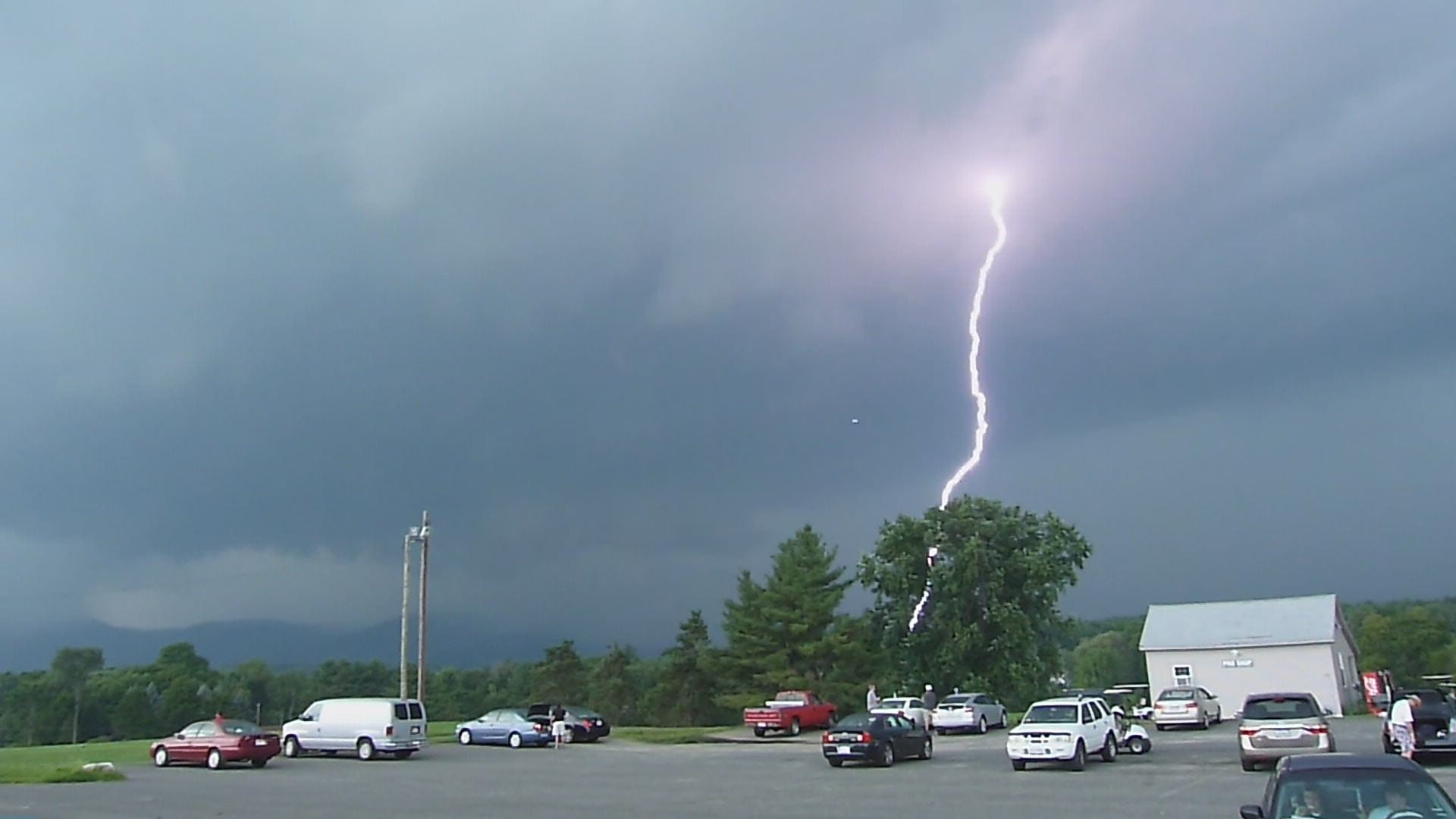
With the recent passage of tropical storm Isaias, even my cell phone carrier was sending out erroneous alerts. Sometime around 8:50AM on August 4, 2020 My cellular carrier sent me a Tornado warning alert indicating to me a tornado was in my area and that I immediately needed to go down to a basement or interior room. I found the message rather odd since upon observation of the sky, I saw nothing in the vicinity that would remotely suggest a severe cell, let alone a tornadic one was anywhere near my area. I immediately referenced the local radar imagery. The closest suggestion of any rotation was over in Franklin county at the time.
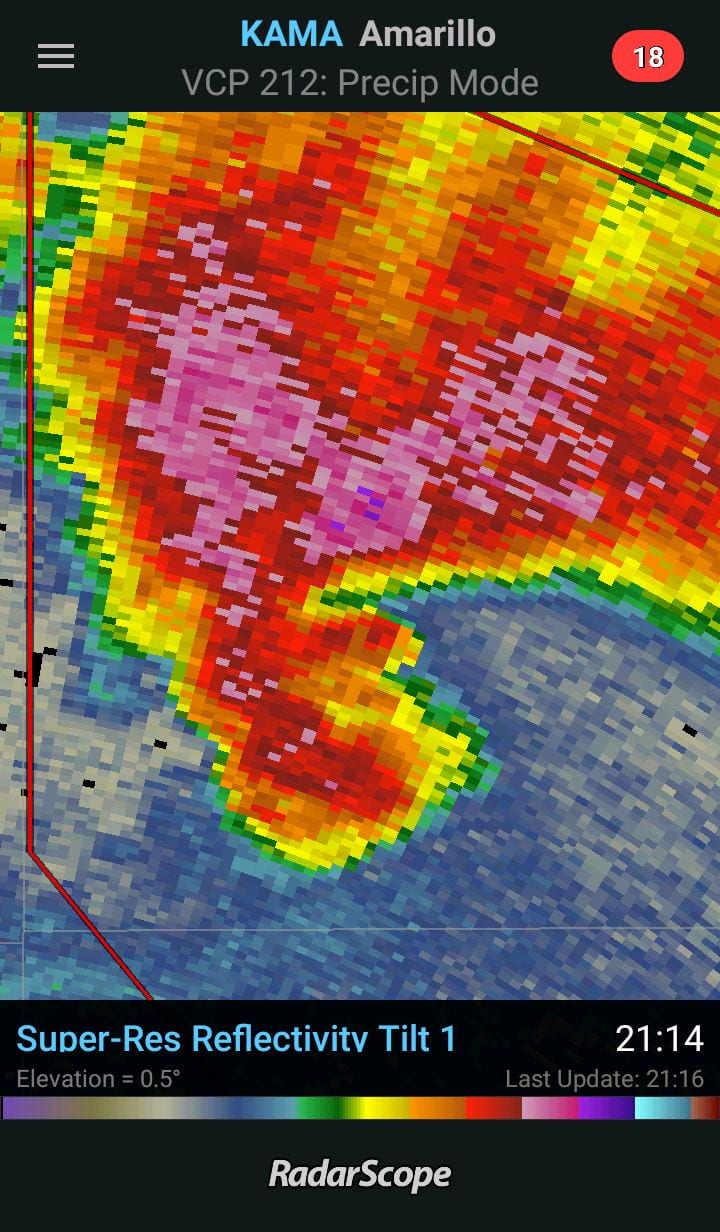
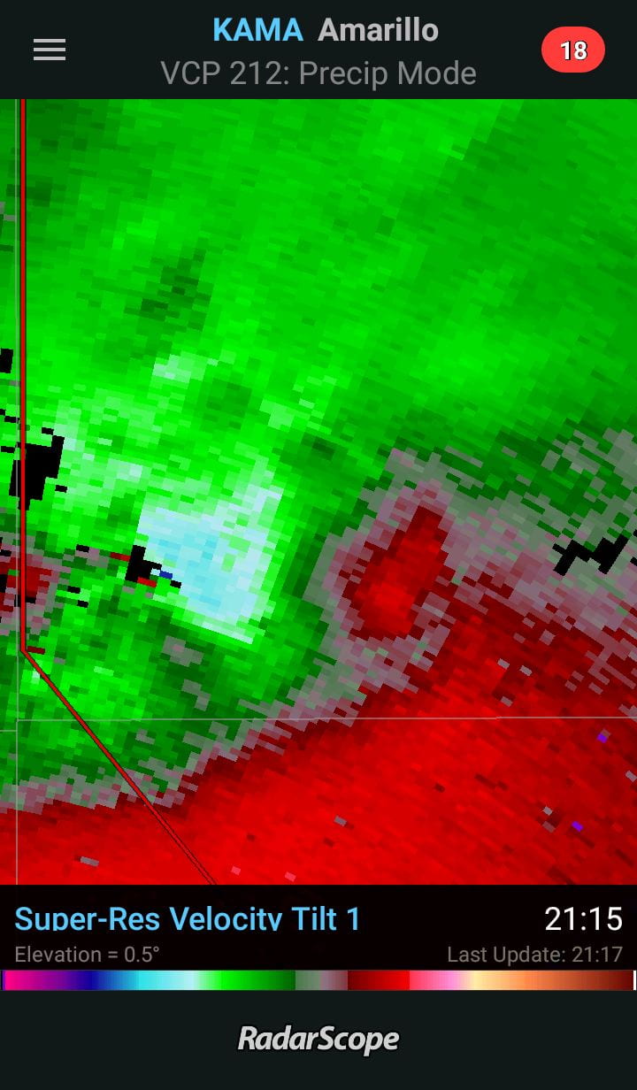
Disregarding my introverted nature, perhaps the time has arrived for me to share a little of what I do know with others. Let’s begin with a little crash course of NWS terminology. A Severe Thunderstorm Watch or a Tornado Watch, means that within and nearby the area where the watch was issued, atmospheric conditions are such that severe weather could occur. That is a watch. Meteorologists are watching for potential severe weather development for a given period of time. However, If the NWS issues a Severe Thunderstorm Warning or a Tornado Warning, that means severe weather is occurring in the area and has been identified by radar returns interpreted at the local NWS forecast office and/ or by weather spotters in the field. The Reflectivity and velocity images out of Amarillo TX are fairly textbook examples. However, given our local latitude and climate, Northeastern regions of the U.S. do not usually get radar returns that are so clear cut, since many of the features are rain wrapped and harder to see due to topographical features of the area. However the signatures of reflectivity and the velocity products still show themselves. An example from the Albany NY. WSR-88D station KENX:
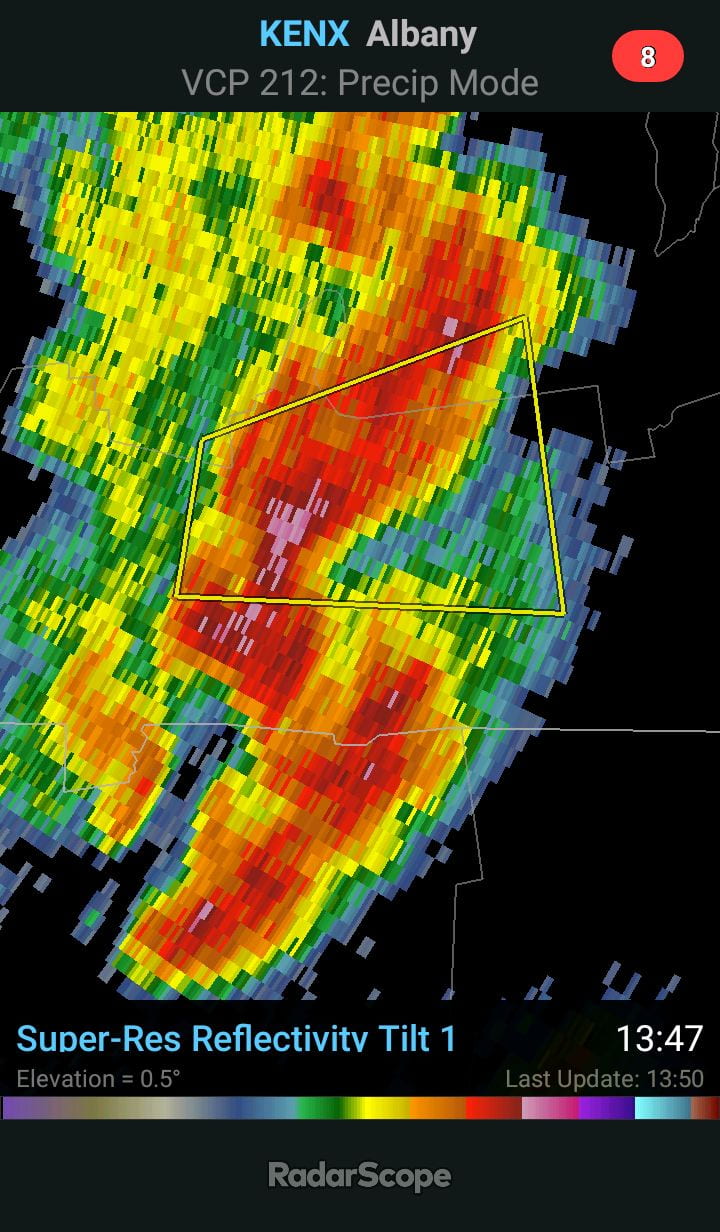
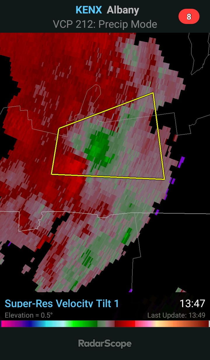

Images such as the ones illustrated above are examples of what kinds of images radar meteorologists see that generate “Severe Thunderstorm and Tornado Warnings”. An easy way to think about the differences between a watch and warning is, A “Watch” means potential for development exists. A “Warning” means the given severe event is now occurring.
Still unsure? I recommend you visit the NWS website:
When you visit the NWS website, they are almost constantly looking for feedback from the public. They too are aware of the confusion by the public regarding their watch, warning and advisory terminology. NWS is in a constant state of change to make their information more understandable to the public.
For the time being, These are the Watch, Warning, and Advisory definitions straight from NWS: https://www.weather.gov/lwx/warningsdefined
So before the NWS issues another “Advisory, a Watch, or a Warning” Have a look at the link above for the definitions and do what you can to familiarize yourself. I recommend, printing out a copy and put it on your refrigerator, medicine cabinet, the coffee maker, the dashboard of your car; anywhere you are likely to become annoyed by its presence. Plaster it to your bathroom mirror and study it. Sooner or later You will be visiting the porcelain library anyway. Afterward, you can relax with a nice cup of herbal tea.